Do it anyway: Utah Bike Tour Pt 3

I don’t think it’s some revelation that the secret to living your life is “do it anyway”; it’s not  crazy or unexpected to realize that when you struggle through hard shit everything else gets easier.  But although I’ve gone through that thousands of times with all the increasingly hard shit and crazy situations I end up in, this was so different.  Long linkup days in the mountains have made me feel like I can get myself into or out of any situation, albeit sometimes with cold quiet acceptance.  That’s the famous “freedom of the mountaineer”, that your body and your skills can take you anywhere safely.  This bike trip, though, expanded that freedom to EVERYWHERE, because it eliminated the tethers.  It makes me feel like even in the worst case scenario situations, I will figure it out, and I will be ok.

Tell me what is impossible but still true: I lived on my bicycle and rode hundreds miles around southern Utah.

140.JPG

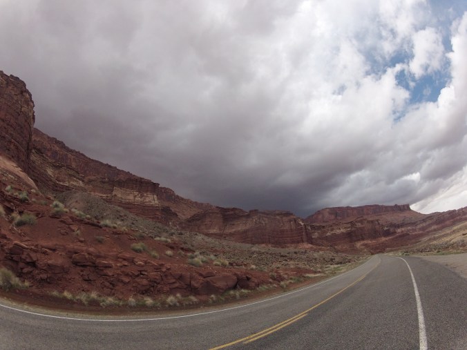
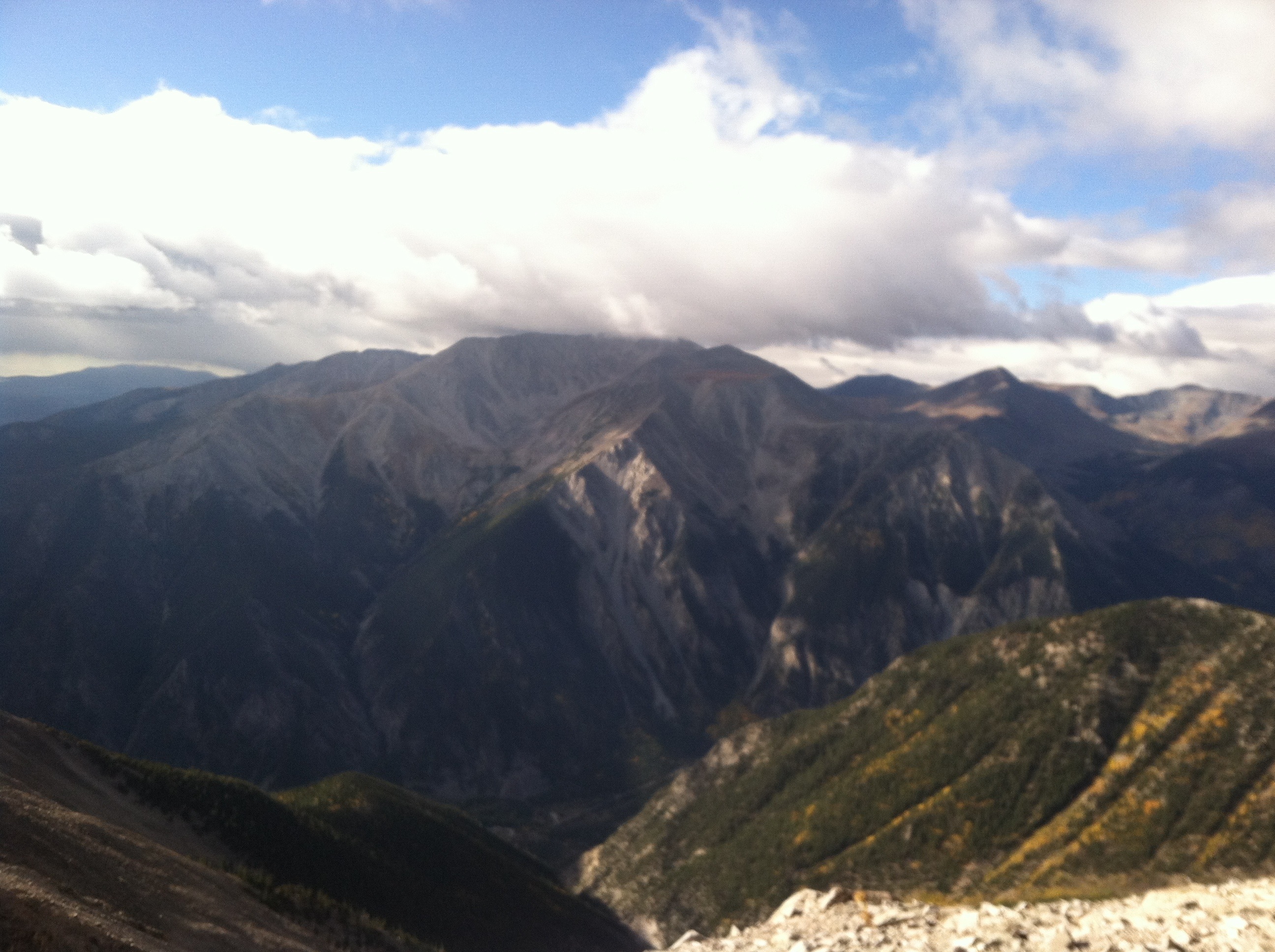
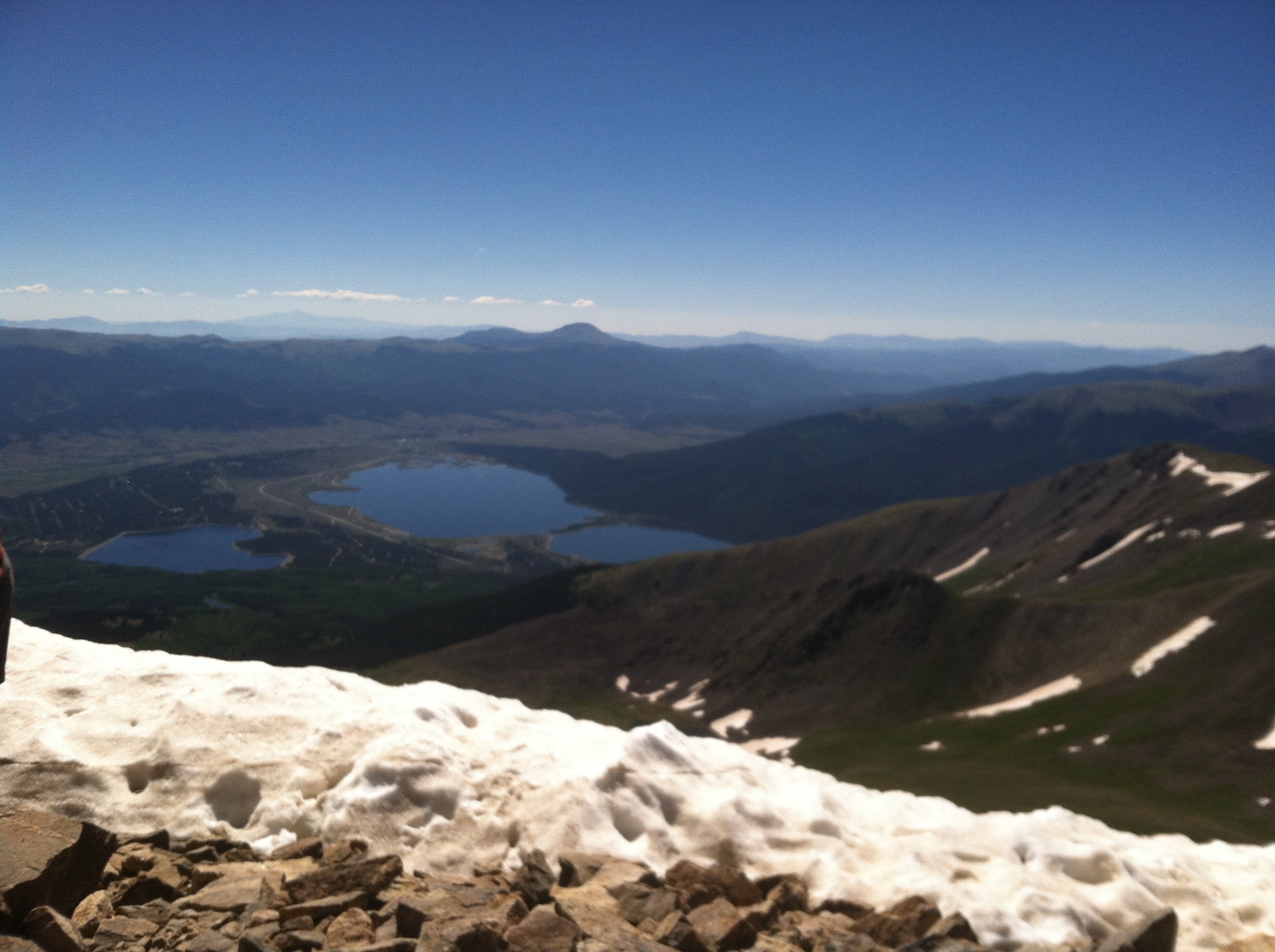
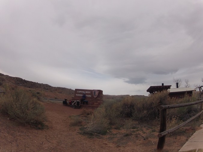
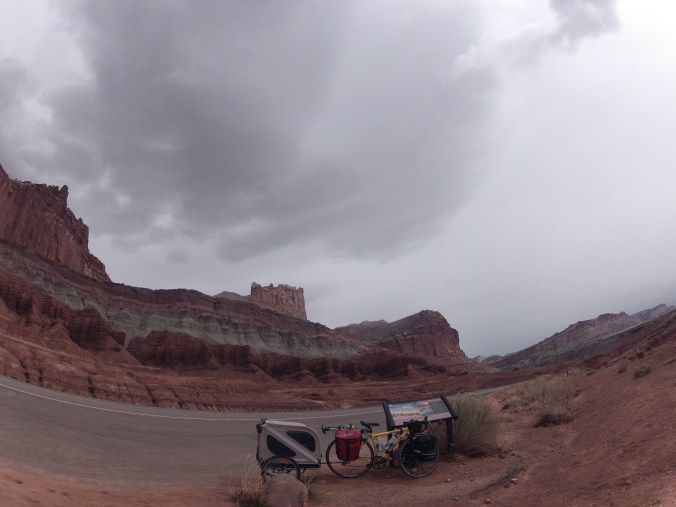
Although nothing that interesting happened in Capitol Reef, the landscape was COOL, and this and the next several photos are from the park

I don’t remember when it was, but I spent hours one afternoon riding and thinking of this thing a first grader said to me in a school that I worked at in Lansing, Michigan years (probably 10) ago.  I rode my bike to that school (and everywhere else I went), it was about 40 minutes from my house I think.  I would come into the classroom with my helmet and gloves tucked under one arm, but I rode in my regular clothes so I didn’t have to change.  It was a poor neighborhood, and my job was paid for by federal grants.  Here’s the exchange:

“Did you ride a bike here?”

“yeah, I always do”

“Do you not have a car?”

“I do actually, but I would rather ride my bike.”

At this point he didn’t say anything, but looked at me with disgust

“Your body can take you anywhere, don’t you think that’s really cool? We’re really lucky to have strong, healthy bodies.”

The kid’s eyes were a mix of pity and confusion, and he just went back to his desk.  I will never forget any part of that exchange, including the way he looked at me, because I had previously been someone that he had some measure of respect for, but in one minute I became someone that he felt bad for.

131.JPG

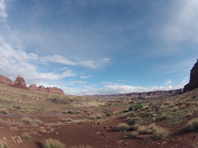
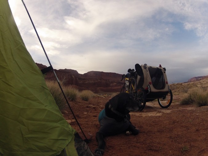
We woke up in the desert, and didn’t get bitten by snakes!  I trapped the spiders that were blocking our exits, and we packed up to go.  In the grey desert, we were just a couple of miles outside the official boundary of Capitol Reef National Park.  The previous night, I had looked over my maps and lists of mileage and elevation gain and thought it was obvious that I would pass through Capitol Reef and onto route 12 that day, then be in Bryce Canyon on Sunday.  I knew something was wrong, so I pulled the maps back out and looked over them again.  I had written the elevation profile in legs, so to speak, and because the towns on route 12 were suddenly much closer, the legs were much shorter.

It did look like: Blanding to Hite 80 mi +4285 -6664

and now it looked like:

Fruita to Grover 17.3mi +2165 -479

Grover to Boulder 28.8 +3077 -3356

and what I hadn’t thought of last night, when I thought it would be reasonable to add several of these short legs together was that I’d be looking at 2 8000ft of climbing days.  Which, pre bike trip, I thought was totally reasonable, as I do more than that on skis and much more on foot in the summer.  What I know now: climbing on a loaded bike with a trailer with a dog in it is at least 30x harder than running uphill.

142.JPG

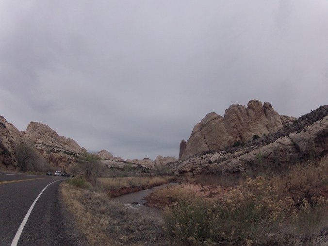
200 million years ago, this was underwater.  The dinosaurs swam here.

143.JPG

I’m pretty sure the Little Mermaid was based on this area.

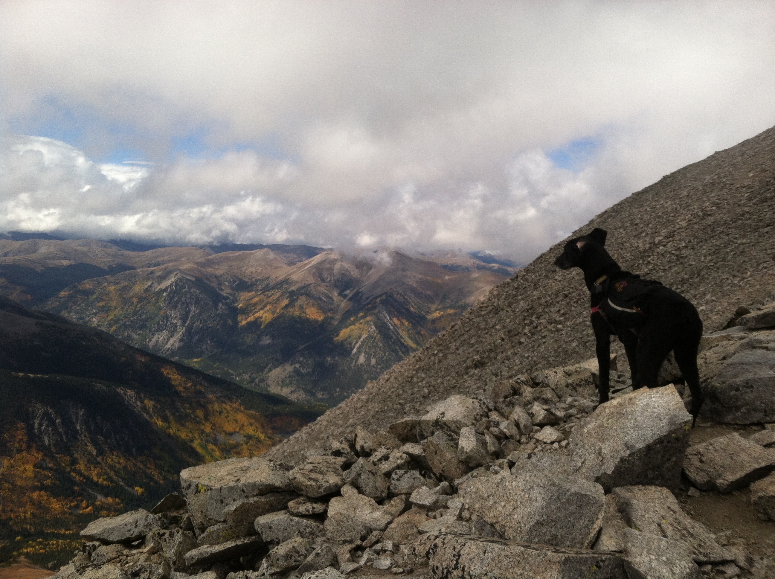
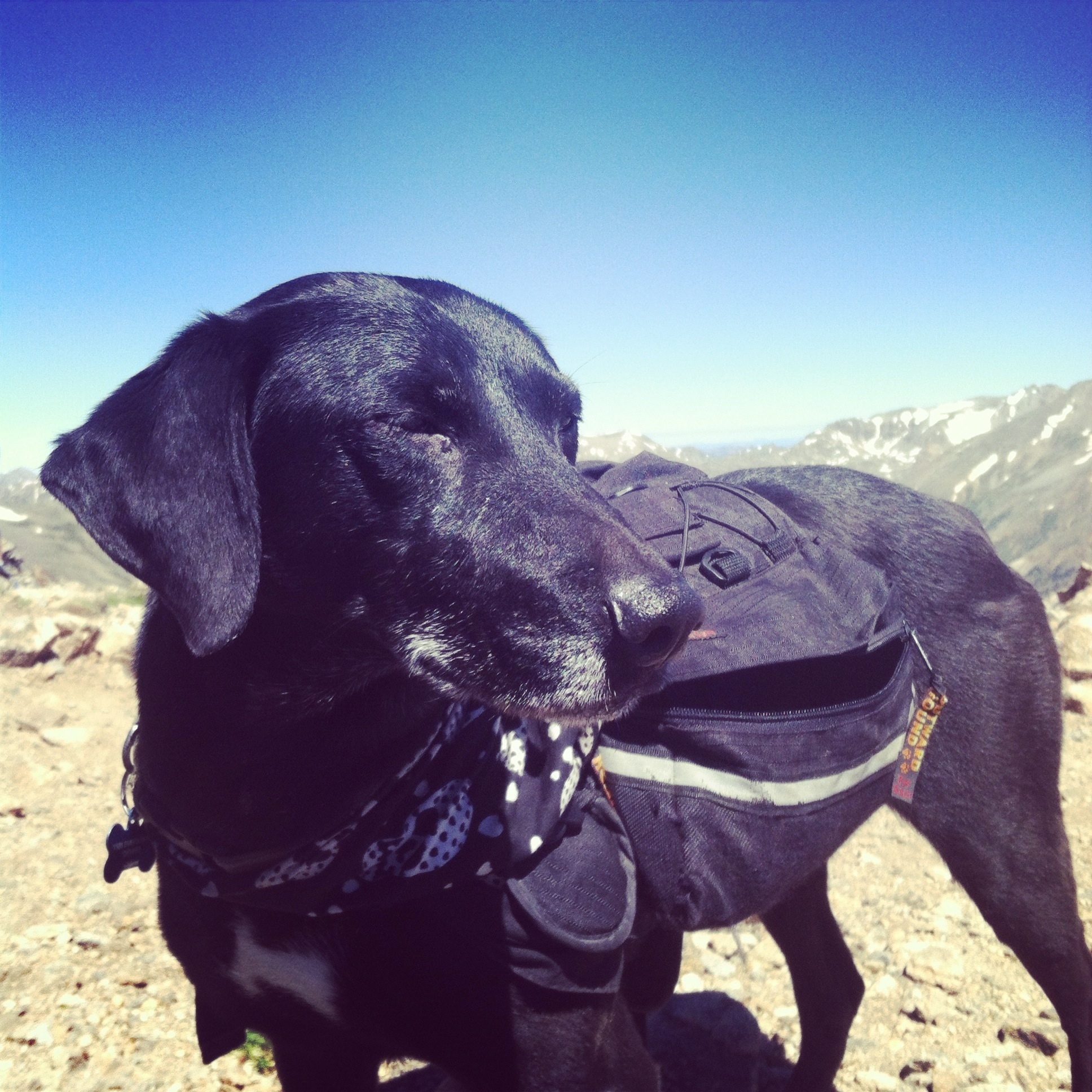
Coming out of Capitol Reef, we spent hours just climbing.  I can’t even think of another way to put it, it felt as though I were just desperately trying to drag a train uphill with only the strength of my legs.  I knew it would be hard, but I thought after the first couple days, I would adapt physically to the work and be stronger.  I think I was, but the hills kept getting longer and steeper.  We were making about four miles an hour.  Each time we crested a hill, I could see better the storm that was ahead, and better feel the wind coming.  The temperature had dropped at some point to 7 degrees Celsius [I had bought a tiny thermometer to put on my bike and didn’t notice until I left that it was only in Celsius.  I haven’t had to translate temperatures from Celsius since like third grade].  The wind came in these crazy gusts, it would hit me like a wall and either stop me or nearly knock me over.  I was trying to keep riding, and when the gust was over, the force that I had been fighting the wind with also nearly knocked me over.  I yelled into the wind “WHY WON’T YOU LEAVE ME ALONE?!”  I yelled at Utah.  I yelled at Luna, because she was cold in her trailer but she also didn’t want to get out and run beside me for the double benefit that she’d warm up and be less weight that I had to haul.  This nonsense went on for hours that felt like days that felt like my whole life.  We crested another hill, and suddenly there was snow.

I pulled over, leaned the bike on a sign post, sat down on the ground, and wept.  I knew the weather wasn’t attacking me personally, and I wasn’t actually mad at Utah, it was me.  I had underestimated the terrain.  I had misjudged the weather.  I had overestimated my own strength (and ability to adapt).  I had definitely underestimated how hard it would be to tow Luna. I had underestimated how much Luna would even want to be out of her trailer and running under her own power.  I was infinitely disappointed in myself.  Here I was, on one of the most beautiful tours in the country, and I couldn’t keep the train moving.  I wouldn’t be able to do the 23,000 feet of climbing over the next three days to make it to Bryce canyon and back in time to ride back to Moab.  And now it was winter.  Because even though I knew how much climbing there would be, I had written it all down, it hadn’t occurred to me that Bryce Canyon is at 9k, which is why there’s all that fucking climbing.  While it’s unusual that S Utah in general is so cold in late March, obviously it’s still winter at 9,000 feet.  I could keep climbing all day, and it would keep getting colder, but ultimately I would have to turn around tomorrow, without having gotten anywhere, in order to make it home on time.  The tour was essentially over.  It took me so long to write part three, because I knew reliving this moment would hurt the most.  My heart broke.  I didn’t have time to finish what I started, I couldn’t, because I wasn’t strong enough, because I hadn’t planned this whole thing out intelligently enough.  The tour was over, and I still had several days of riding left to close the loop and get back.

151.JPG

But there was nothing else to do but ride.  And for a few more hours, the wind pounded me, and I struggled and suffered, and finally I stopped to take a break.  I had accidentally stumbled upon a BLM historical site that featured a couple sweet campsites, and I thought, “I have fucking HAD IT.  I do not want to ride anymore. I am DONE for today.”

154.JPG

This is a historical site because the Native Americans used the holes in the rocks to store grain

Really, I think that about sums it all up.  Yeah I rode for several more days and put in a really hefty amount of mileage.  There were good times and bad times.  There were times I thought drivers were going to kill me, there were times I was super stressed out, there were times when the mileage and hours just rolled by.  There was sun, there was more rain.  I came to terms with my disappointment in myself.  It was hot sometimes and it was cold others.  I had some delicious french toast, and I ate a lot of fuel that I didn’t care much about.  We had a couple more good campsites.  We talked to some interesting people.  A photographer stopped me and asked to take some photos.  It made me really uncomfortable, but I obliged.  She said, “what you’re doing is extraordinary.”  I said thanks, but what I thought was “it just feels normal now”.  An elderly woman gestured to the rig and asked if it was my home.  I said “for now”, but I wished I had said “yes.”  There were more spiders, there were more miles, and I got bitten by a fire ant (it hurt more than expected).  There was another very violent storm, during which I got a flat tire.  My rear brakes came loose.  The derailleurs were struggling to shift at all on the last 2300ft climb.  I got another flat tire.  I was just about to type that I fell apart in the last 10 miles to Canyonlands, but I didn’t.  I didn’t fall apart.  In the middle of this super violent storm, I considered my options and started running, because it seemed more reasonable to get back to the truck instead of trying to fix the bike in the storm at 7:15pm.  Ultimately, a nice family gave Lu and I a ride for the last couple miles.  There was no triumphant return, it was just over.

210.JPG

There’s a Mario Kart course based on this area I’m pretty sure.

215.JPG

222.JPG

I believed during the various periods of suffering that after the tour was over, I would only remember the good parts.  Well, shows how much I know.  I miss all of it; the bad, hard, scary, miserable parts just as much as the joyous descents, sunny miles, and sweet campsites.  I can feel the fear and worry, the cold, and my aching body as if I’m still out there.  And I want it back, I want it all back.  I had been afraid of losing safety and security, and comfort; of being too far away.  I didn’t realize I had been afraid of living directly in the environment for a length of time, of being exposed, of deprivation.  This tour has changed everything.  I used to want to be fearless, and believed that by continually facing my fears I could evolve to a point that I had none.  That’s impossible, because fear is what makes you human, and I don’t ever want to be without it.  Choosing to do it anyway, THAT is freedom.

“Paralyzed by the voice inside your head, it’s the standing still that should be scaring you instead.  Go on and do it anyway.  Risk it anyway.

Tell me what I said I would never do, tell me what I said I would never say.  Read me off a list of things that I used to not like but now I think are ok.” -Ben Folds

(who knew Ben Folds was this brilliant philosopher?)

077.JPG


Utah Bike Tour 2017 pt 2

Another storm was coming in, it was getting increasingly dark, and I had put in 30 miles since Blanding with no sign of this super hard climb that I’d heard about.  As my morale was falling apart after an otherwise great day, I dragged poor Blow and the rig through the red clay to a secluded spot and set up camp.  The storm didn’t wait for us to be safely in the tent, the temperature dropped twenty degrees, and the rain came in huge heavy drops.  I read Franny and Zooey out loud to Luna, and tried my best to seal the tent from spiders, snakes, and scorpions.

When we woke up in the morning, it was still cloudy, still wet, but now it was also very cold.  I guess because the sun wasn’t going to shed its’ light on anything today.  And I still had this climb to deal with.  I stayed in the sleeping bag for a bit, wondering what to do, when I realized there isn’t anything to do.  There’s no choice, no decision making, nothing, NOTHING at all to be done.  It was time to pack up and ride.

051.JPG

When I put the computer on the bike that morning and I saw it was only 7a when we were departing camp, it was my first taste of what I’m going to call “tour time”.  There is no 7a or 7p or noon on a bike tour, there’s: wake up time, pack up time, eating time, bathroom time, eating time, too beat to ride anymore time, set up camp time, eating time, and dark.  There was a couple more hundred feet to climb (and thank GOODness because I needed something to warm me up) then the hills evened out to a roll.  We would dip down into a small canyon, then climb out of it, and so on. We came upon one of the spots Steve had told me to look for water, and there was a little stream so I topped off our supply as we were still 50 something miles away from Hite, the next resupply. [and NOW I’m thinking STEVE why didn’t you mark on the map where this mystical climb was supposed to be!?]  And so the miles kept ticking away, and it kept raining off and on, and it kept being cold, and I kept not coming across this mythically terrible climb, and suddenly we were at the former settlement of Fry Canyon [I would like to bring attention to the fact that spell check doesn’t believe at least 7% of the words that I use are words at all, and I’m just not sorry for it.  Mythically seems like it should be a word, and I still think it is.  Fuck you spell check, you don’t know anything and nobody wants you.]

DCIM100GOPRO

the abandoned fry canyon settlement

So the MYTHICALLY terrible climb was already over apparently, and wasn’t so bad at all since I remember some climbing but not some terrible dread-pirate-8-mile-climb.  Fry Canyon on to Hite was said to be “all downhill” which is obviously never true, but it was mostly downhill and I besides my numb hands and feet, I felt glorious, like I understood what bike touring was all about.

052.JPG

As we rolled into Glen Canyon National Recreation Area, the motherfucking sun came out!

059.JPG

And I understood what it means to live in your environment.  Without climate control and just some bags of tools and gear, and a simple machine like a bike, I was “exposed”.  And yeah, it was uncomfortable sometimes, but as soon as you accept that, you get used to it.  There’s a word in sanskrit, santosha, that’s generally translated as “contentment” but I’ve always thought of it is being okay with the situation, all the good and all the bad.  When I used to work with kids and we’d hand out crayons or something, we’d say “you get what you get and you don’t throw a fit” and that’s exactly it.  Sometimes you get rain, sometimes you get sun, sometimes it’s freezing and sometimes it’s hot and there is NOTHING NOTHING NOTHING you can do to change it.  You can go in your heated house and pretend that’s real.  But it doesn’t stop the world from being hot or cold or sunny or rainy or windy.  It only seems like suffering because we’ve become so sensitive.  The real world is tumultuous, but you can actually live there.  For a day, or ten days, or you can even move there indefinitely.

Anyway, Glen Canyon NRA was gorgeous with really a dramatic landscape.  It turns out, Hite is basically a ranger station that seemed quite deserted.  There’s a “store” there with a lot of empty shelves but I somehow managed to get my hands on a can of coke.  There’s a sign suggesting that you pay the fee to visit the park (but I never saw a single person to enforce it)(and I had a federal inter-agency pass anyway so don’t go assuming I didn’t pay to get in).  But there was water, and that was what was important.  After Hite, 95 takes a windy and quite drunk path through the park, going abruptly in every direction about equally so at the end you feel you’ve done a lot of miles but not gotten anywhere at all.  But one of the other Most Memorable Moments of my trip was about to happen.  Utah apparently has a penchant for roads with steep grades that take hairpin turns through blasted out canyon walls then suddenly sweep into totally and outrageously epic views, which is how I found myself again at 40mph, plunging down to a bridge crossing the Colorado River.  And I knew it was the CO before the sign on the bridge, and I did not see it coming as I only vaguely looked at the maps for this area and I assumed I was about to cross some small tributary to Lake Powell, but then it was THE COLORADO RIVER in all its’ magnificent splendor, the sun reflecting off it overzealously, the way a kid would paint it in elementary school.  I exclaimed at the top of my lungs something like “WHOA HOLY ***** *** *****”, not anticipating that there was a person on the bridge, but I’m 87% sure he did hear it based on the way he greeted me when I passed him.  I didn’t take that picture either, and couldn’t have as there was no way I was going to stop in the middle of such a grand downhill, but I did take a picture on the other side:

063.JPG

So it’s all beautiful and sunny here, then suddenly, I went through another hairpin turn through a blown out canyon wall and a very aggressive storm was there.  It was dark and so windy it not only stopped me (and the freight train I was piloting) completely, but knocked me over.  Interestingly, I crashed twice and both times there was a car behind me and neither time did they stop to make sure I was okay.  Thank goodness for the handful of nice people I came across on this trip, because most people are kind of assholes, and if it weren’t for those few good folks I would think humanity is in the toilet.  Anyway, it was only 3:30, but I wasn’t going anywhere in that wind (because it was physically impossible to ride against it apparently), and I didn’t really want to, so I put Blow in the vestibule of a pit toilet (see how I added a touch of class there?)(not the same toilet that humanity may or may not be in) and put Luna, all our gear, and I inside the tent.

066.JPG

the second most violent storm of the trip

And then it raged.  I’m still amazed that wind didn’t tear my tent to pieces or pick it up and throw it across the canyon with us in it.  Perhaps needless to say, the tent flooded, and really we should have all been in the vestibule of the pit toilet.  It went on for about an hour, Luna piled on top of me looking despairing and trying to escape the new Lake Powell that had formed in the tent (what I’m trying to say is, there was more water in my TENT than in Lake Powell).  But then, because all weather is is a bunch of interesting physical reactions, and I know that it has no personal vendetta against me but is, in fact, just being itself, the storm cleared up and the sun came out:

068.JPG

While I was retrieving Blow from the vestibule, as if the apocalypse hadn’t happened at all a truck drove up and a lady got out to use the bathroom, and she stopped dead in her tracks and said “ARE YOU ON A BIKE?!” and I said yes, and she asked about the dog, and I said she has a trailer, and the woman looked taken aback for a moment then resumed her business, shaking her head.  New Lake Powell dried up, and I considered riding on, but this campsite was fucking rad, so we stayed.

074.JPG

It was so windy at night it woke me up and in my sleepy stupor I was sure I woke up to footsteps just outside of my tent.  Despite how much I dislike desert predators, I’m still much more afraid of people than anything nature could throw at me.  But it turned out to just be the wind thwap thwappping the tent fabric somewhat violently.  Then there was a beautiful sunrise:

075.JPG

And just like every day, it was time to pack up and ride.  There was a long climb, then this:

079.JPG

Then a long sunny day of rolling hills and miles (during which I obviously fantasized about my future in stage racing) all the way to Hanksville, where I had a lovely fountain Coke and ice cream and resupped on the important supplies, like chips and candy, to the chagrin of the 15 year old cashier (“will that be ALL ma’am?”).  Because the miles were coming so easily, I put on 25 more before finding a cozy campsite amongst dozens of snakeholes right on the edge of Capitol Reef National Park in interesting terrain that I could only describe as a weird, grey desert.  To be continued.

104.JPG

Sunrise from the weird grey desert campsite

All you gotta do is jump: Utah Bike Tour 2017 pt 1

I really wanted to get my thoughts down right away about all the things that happened in Utah in the past 10 days before anything slips away, because I’ve already noticed after being home less than 12 hours that it’s surprisingly hard and surprisingly easy to adjust back to regular life.  I think human adaptivity is one of our greatest qualities, as a day ago I had been adjusted to waking up in a flooded, ice cold tent and my morning spider trapping duties.

On my last night on tour, a family gave me an 8 mile ride and the daughter, who is around 12 I think, told me she’s too lazy for biking or for running.  There was a book in her lap.  When I was 12 I would’ve said the same thing probably when my dad came home from a tour.  I’ve wanted to go for a long time and it’s been one thing I was too scared to go through with.  Why?  Because I’m tethered to the relative safety and comfort of the truck and my house.  We use words like “hostile” to describe the environment and weather when it makes us uncomfortable, and words like “exposure” to denote the danger of living in that environment, the real environment; the one that we haven’t manipulated.  The reality of humanity is that we don’t at all live in reality, we live in a web of environments that we’ve manipulated into being safe and comfortable.  Cars and houses and buildings with climate control, packaged food, machines and tools that we don’t really understand but are designed to make our lives easier.  Running water, indoor plumbing, and cell phones.  The number one thing people responded when I told them about this tour, before during or after, was “that sounds miserable”.  I guess it was, if that’s the way you’re going to look at it.

003.JPG

I was so excited, anxious, and afraid on the drive to Utah that I swear my heartbeat shook the truck.  Unloading the bike and my baggage and setting up the rig, my hands shook madly.  It was sunny and beautiful, and as I dragged the whole thing down the sandy BLM road I was parked on back to highway 313 I began to think the whole thing was impossible.  It was so heavy, and so far, and I would have to leave my tether to safety for a long time, and get impossibly far away from it (which is one thing that makes bike touring much scarier than backpacking, the sheer mileage).  But there was nothing else to do but get on the bike and ride it, so that’s what I did.

blow and lu by moab 2.JPG

The excellent Moab bike path is dotted with mtn bike trails, and uncrowded enough that it was the only time Lu got to run untethered next to me while I rode.

The first day was magically easy; the weather was good and it was pretty much all downhill to Moab.  There’s a magnificent bike path between 313 and Moab so you don’t have to ride on the highway until you’re just about in town.  Which is nice, because riding 191 on any of the days I had to do it was one of the worst and scariest things I’ve ever done.  I slept on BLM land maybe ten miles south of Moab, and day two was the first of several days I woke up to a large and poisonous spider hanging from the door of the tent.  I was sufficiently terrified of the predators of southern Utah, because they’re hard to predict and understand.  The internet suggested making sure the tent is zipped up all the way, never walking around without shoes on, and some golden advice, “spiders, scorpions, and snakes are more afraid of you than you are of them.”  Well internet/National Park Service/Utah state government, I would like to assure you that spiders are not afraid of people at all, in fact they routinely broke into my tent to be closer to me despite my best efforts to seal them out.  So what do you do when a large, colorful, and poisonous spider is blocking your only exit?  I thought hard about cutting a new exit into the back of the tent, but instead I trapped it.  I felt sick all day, and I don’t remember if I woke up that way but I could hardly eat anything all day.

013.JPG

Luna: all play, no work

Day two was hard.  I knew it would be, in fact I had imagined the first couple days would be very hard, adapting to full days in the saddle and towing that heavy ass trailer, and then I would be stronger and start mashing miles.  I also imagined that Utah was basically flat (even AFTER writing out the elevation profiles for each leg of this trip), and that they never had winter.  People make mistakes.  Moab to Monticello is just all uphill, divided into steep climbs and long low grade climbs.  The shoulder on 191 is taken up with the most enormous rumble strips I’ve ever seen, thousands of potholes in a row.  Also, I think anyone would imagine that towing a trailer with a dog in it would be harder than riding a bike without it, and climbing with a dog and trailer is harder than climbing without it, but what I hadn’t at all prepared for was that downhills feel like flats and flats feel like climbs.  And that climbs are now basically impossible and require maximum effort to keep the whole freight train moving at all.  And that’s the story of how you can ride for ten hours and only get 50 miles in.  There was so much traffic between Moab and Monticello, I imagined Monticello must be the size of Denver.  It’s not.  I’ll always wonder where all those people were going, so aggressively and in such a hurry.

We slept at a campground in Monticello, as it was already 7:30p when we got there and I was too brutalized by climbing and traffic to ride anymore anyway.  The proprietor was like an old western grandpa.  It was 30 degrees that night.  Day three I woke up still feeling ill, but at least I knew I’d be off of 191 before long.  The hills between Monticello and Blanding evened out, were more rolling, and by the time we got to Blanding I was starving, finally.  I had breakfast at a diner where both of the employees looked me up and down long and hard but didn’t have anything to ask or say about it, and I put down the whole plate before the waitress came back with a napkin.  Topping off my enormous reserves of water (8 liters) at the visitor center before we left, a nice older man named Steve marked on a map for me where he thought I could find wild water in the canyons along highway 95.  He also told me that in the summer as many as 30 cyclists per day departed from Blanding to ride 95, but they’re generally supported and in groups.  “An intrepid adventurer like yourself is very rare indeed.”  Thanks, Steve.  [In fact, I didn’t see one single cyclist until 24 between Hanksville and Capitol Reef NP].

016.JPG

I will now always have a deep, visceral reaction to downhill steep grade warning signs.

Once on 95, there is almost immediately an 8% downhill.  Normally, I would have been braking the shit out of that hill on a massively loaded bike (with 16lbs worth of water, at least 5 days of food for me and Lu, in addition to all the gear) and towing precious cargo.  But the version of me that was somewhat brutalized the previous day threw caution to the wind and I found myself descending the serpentine road into the canyon at 40mph.  In time, I think I’ll remember few details about this trip, but that moment of delight with all of Fry and the surrounding canyons suddenly opening before me, I will never forget.  It makes me feel so overwhelmed every time I think about it, it was the first time I understood the freedom of touring and it felt like all of Southern Utah was at my disposal.

022.JPG

The road came through that little notch in the ridge.  This isn’t looking back on the joyous downhill I wrote about above, I didn’t take that picture.  In fact, I don’t think I have pictures from any of my favorite moments, those will live in my memory forever and nowhere else.

I know a lot of people start tours from Blanding, but that downhill could not possibly be as satisfying without the 7k of climbing leading up to it.  So, Steve had warned me that there was a big, 8 mile climb starting 20 miles west of Blanding, and after that I’d be home free.  I had hoped to get that climb out of the way that afternoon, but I just seemed to never get there.  Since this is turning out so long, I take it it’s going to be in the format of installments.  So, end of part one, to be continued.

036.JPG

MOTHER NATURE (and how I learned about expectations

Mother Nature exposed and made light of my weaknesses by dumping foot after foot after foot of fresh snow on my mountains; they that were so near to being clear.

When it started snowing on Wednesday I was annoyed. When it continued snowing on Thursday I was already pissed. I thought after work I would run all day. I adjusted said plan to spend the afternoon swimming laps instead, but when I arrived at the pool the sun was coming out and I cut my swim short to run Ptarmigan…only to find the sun immediately replaced by another snowstorm. And how it stormed. Friday I woke up to a full foot of new snow, and to put this in perspective that’s enough snow that I couldn’t open the back door to let Lu out in the morning. I shoveled the foot of snow off of my car and went to work, only to return to another FOOT OF SNOW in the afternoon; so much snow you couldn’t even see the dent in the driveway from the foot of snow I took with me in the morning (I totally got stuck in my street). Saturday it snowed, and Sunday it was occasionally sunny but it also snowed.

You may remember that I was recently thrilled about the amount of exposed trail up here, and the impending spring and summer when I would get to run on the ground again. I can’t even dredge up hope for that dream anymore, and here’s why:

So yesterday I looked at conditions reports on the southern Sawatch, and as recently as 8 days ago someone was on Mt Yale reporting that the first couple MILES were dirt, and there wasn’t enough snow anywhere to ski. The weather was reporting 50’s and sunny in Buena Vista, so I thought good enough, let’s go. Lu and I drove to BV in the mid-morning, coffee-in-hand, and arrived at the Denny Creek TH parking lot that had been thoroughly plowed and sunned and was perfectly empty at 10am. It was sunny and relatively warm. I did Yale towards the end of last summer but I was racking my brain trying to remember where the TH actually was from the parking lot, and boy I wish I had taken a picture because it was comical when I realized that it was so thoroughly buried with snow that you couldn’t see the sign, and there were no tracks to speak of.

I’ve gotten used to this common mountain scenario since I’ve moved here: there’s a baselayer of snow, someone makes tracks on it, when it snows again you still have the packed snow beneath it. Well. This was much different. There was no baselayer and no previous tracks, just the dirt trail. Like this was the first snow there ever was. And it was three. fucking. feet.

I dug out my snowshoes and sighed.

Luna doesn't care if she's buried or not

Luna doesn’t care if she’s buried or not

An hour later, we had lost the trail and the sun and it had begun to snow. We arrived at a river crossing and I nearly fell in. Each sluggish step in the wet snow dragging each snowshoe miserably. Yeah, I was totally angry. I know it’s not right, but I’m just done with winter and I’m so mad it snowed again [and hey, guess what! This is the usual for the high Rockies. Silver Lake, Colorado holds TWO U.S. records for snowfall-the most snow in 24hours (76”) and the biggest continuous snowfall (100” in 85hours) and it was a late April storm]. The reality is, our snowfall was really light this year and we NEEDED this huge storm so we have water this summer; okay, I totally get it! But it doesn’t make me feel better about the current state of dragging ass in the cold woods [especially when I tasted summer in that glorious weekend I spent running the front range]

this water.  was delicious.  and the coldest water that exists in the world.

this water. was delicious. and the coldest water that exists in the world.

It gave me a lot to think about. When I was still teaching yoga full time I did a 5-week series about expectations. How and why we have them and their effects on our lives and well being. Others expectations of us. What it boils down to is something we all already know-expectations set us up for disappointment. I’ve been dreaming so hard of summer and the weather was good so I expected it to stay that way and get better. It took moving up here to realize that you can never rely on anything when it comes to weather. I know, I know, in your part of the country the weather is CRAZY and unpredictable and you can have all four seasons in the same day (are you realizing for the first time that you’ve totally said that, because EVERYBODY thinks that about where they live? Is your mind blown!?)

But here’s the thing about the high country. It goes from 50 and sunny to 0 and storming in less than five minutes, and I’m not exaggerating for effect. I counted (for the first time) and it went from sunny/clear/warm to FULL ON SNOWSTORM and back 7 times today. SEVEN. It might be 60 degrees and sunny for two weeks, then it drops the biggest storm of the year on you and pummels you for days with January temperatures. It’s also not unusual for this to happen once summer is in full swing; in fact, it’s likely to happen several times this summer that we get sudden snowstorms. Plus, at high altitude (I’m at 10,200) the sun feels hotter and it warms us (people, land, air, whatever) up faster, and the thin air doesn’t hold heat very well, so the temperature swings can be truly incredible.

My weakness this past week has been my expectations. But I’m not going to get anywhere training for Nolan’s holding a grudge or staying inside to avoid snow because I was ready for summer. I could let every step be wretched, feeding the anger and frustration. Or every step fuels the fire that burns out my weaknesses. Self discipline through austerity-and once that garbage is burned off I won’t even notice the snow, excepting the lightness of burdens being lifted.

fresh tracks

fresh tracks

27 (all systems go)

I headed to Buena Vista on Monday with certainty that this time, the Sawatch Range was going to get wrapped up. With just Antero and Princeton on the docket, what could go wrong? Well, the weather was forecasted to be terrible. But I wasn’t overstretching myself this time, I planned Monday and Tuesday for this trip so there was basically 98% chance that I’d make both summits.

Planned (and actual): Mt Antero (14,269) 16mi, 5200ft gain and Mt Princeton (14,197) 14mi, 5400ft gain

Antero.  I took this the next day from Princeton.

Antero. I took this the next day from Princeton.

As I mentioned before, Mt Antero is a part of the “highest network of ATV trails in the country” (congratulations, whoever thought wilderness was a good place for that) so you hike up the ATV road pretty much the whole way (and btw, whoever is in charge of trail building, I will learn how to build trails just to build a real trial up Antero; it is insane that nobody’s done it). And it’s just mileage and gain. Mileage and gain. There was some rain on the way in, but not by any means the worst thing that’s ever happened. Because of all the water, though, the rivers were wildly flooded. The first river crossing is so wide that it spread out the extra water and I could still cross at the designated crossing. The second crossing, however, was well above the rocks to cross it. I ended up taking off my shoes and pants to wade across. It was one of the coldest moments of my life (spoiler alert-things get much colder next week). It was maybe 40 degrees and I wasn’t up high yet, I wasn’t about to spend the rest of the mileage in wet pants.

Needs no caption.

Needs no caption.

The rest of the way up was pretty uneventful. When you finally reach the top of the road, you’ve got maybe less than two miles left climbing up the talus field to the summit. It was actually partly sunny for this part.

On the way up the talus field

On the way up the talus field

Arriving on the summit, the view was epic and the clouds, with all the crazy wind, felt like they were on some kind of turbodrive. You know how people build forts on the summits for protection? Someone had built one like a throne looking out to the west. Lu and I stayed there about ten minutes, snacking on trail mix (you know, Whole Foods apparently discontinued my favorite trail mix!? Even more reason to finally make my own. Some day.)

At first, it was cloudy and windy on the summit

At first, it was cloudy and windy on the summit

then, it looked more like this.  Taken from my THRONE atop Mt. Antero while I snacked gloriously on trail mix.

then, it looked more like this. Taken from my THRONE atop Mt. Antero while I snacked gloriously on trail mix.

Then, suddenly, the temperature dropped about ten degrees and the wind picked up. I packed up the trail mix and Lu and I ran off the summit as fast as we could. We made it back to the road, where a nearby smaller peak offered marginal protection, before the storm rolled in. It got dark and wild fast, the wind picked up so much I could lean most of my body weight into it and it took an incredible amount of energy to continue. The precip was what I like to call RAILS. Rain/hail/snow. It was hard and sharp but wet and frozen all at the same time. Things were pretty iffy until we got back to treeline, but honestly the experience (though miserable) made me wonder why I worry so much about storms.

Back below treeline, the precip mostly stopped and the wind was broken by the environment. I saw a herd of mountain goats (picture turned out AWFUL even though they were SO CLOSE) then the sun actually came out eventually for the last bit. I passed a guy on an ATV headed in and he stopped to ask me if I’d been caught in the storm and if I’d seen any mountain goats. He confirmed that he’d seen the same herd the day before, then shared with me that he’s an archer and has a permit for hunting mountain goats. Insert horror/crying here. Hunting mountain goats. Is a thing. Have I mentioned lately how I sometimes question humanity?

Tuesday was serving up Mt. Princeton and I woke up in good spirits, ready to rock. For what I’m pretty sure is the very first time, I was on the trail early enough to see the sunrise.

FINALLY I get to see a sunrise.

FINALLY I get to see a sunrise.

Princeton is another sob that has no trail of its own until you hike up an insane ATV/Jeep road for miles and miles and miles. (again, who do I talk to about this? I will build the damn trail myself.) Not surprisingly, no traffic on this mountain either. I eventually saw a car pass me with an older couple in it that stopped, got out, and got back in and drove back. They were the only people I’d see for the whole day.

and after the sunrise.  still awfully nice.

and after the sunrise. still awfully nice.

So you finally get on a trail for the last couple miles and it’s all talus from there. I mean miles, and miles, and miles of talus. When you finally see Princeton for the first time, it looks so big and so very, very far away.

so. far. from here.

so. far. from here.


And the thing about talus is, it takes so long to pick through it that it doesn’t feel like you get any closer. This was the theme of the trip. It’s taking forever and the summit is not getting any closer. The weather was turning slowly but surely as I headed up, but after the two storms I’ve been in in the last week or so, I’m honestly not that worried. Unless there’s lightning. The final ascent was a real practice in triumph of the human spirit. Definitely one where I thought I’d rather be doing anything else but this. Just slogging and dragging and misery all the way up. Didn’t spend long up on the summit, the view was…lacking.

check that view!  of...clouds.

check that view! of…clouds.

The talus field on the way down and out didn’t go any faster. It was maybe even slower. Needless to say, I wasn’t in high spirits anymore at this point. However, the trail mix I had with me had peanut butter cups in it. So I had that going for me, which was nice. Making it out of the talus field though….now that was an epic moment. Maybe even better than summiting? Although if I hadn’t summited I wouldn’t have felt so good right then. The whole way down the road I daydreamed about attempting Nolan’s. (if you’re curious…http://www.mattmahoney.net/nolans14/)

On Wednesday, Mark and I were scheduled to go back for the 2 Mosquito Range summits that we had missed back in like May (Lincoln, due to dangerous icy ridge and Democrat due to a cut on Luna’s foot), and back Sherman while were out there. Sherman is the most depressing 14,000ft mountain I’ve ever been on. The trail is an old mining road, the mountain itself is unappealing, and there are no good surrounding views either.

the one and only picture we took on #25, Mt. Sherman

the one and only picture we took on #25, Mt. Sherman

Lincoln and Democrat, however, offered epic views and a little bit of fun.

Summit of Democrat.  I ran up it, collapsed on that rock until mark got up there, and posed like a badass for this picture.

Summit of Democrat. I ran up it, collapsed on that rock until mark got up there, and posed like a badass for this picture.


I'm totally up there.  That's the summit of Mt. lincoln

I’m totally up there. That’s the summit of Mt. lincoln

It had been a long day with the driving, Mt Sherman, more driving, and two more peaks to bag, but we were still keeping it together. There was much discussion of 80’s movies, which made the elevation gain pass faster than anything ever. There were a lot of people out, including a couple different groups of stoners (again, hiking fourteeners is what stoners do in Colorado?! Amazing. I only played the sims back when I smoked pot.) Summiting Democrat felt especially good since it was NUMBER 27.

TWENTY SEVEN 14,000+ft SUMMITS IN ONE YEAR

TWENTY SEVEN 14,000+ft SUMMITS IN ONE YEAR

20141007-095907.jpg

In anticipation of my birthday next week, and my 28th peak in my 28th year, without further adieu here is the list:

Quandary
Pike’s Peak
Gray’s Peak
Torrey’s Peak
Mt. Evans
Mt. Bierstadt
Mt. of the Holy Cross
La Plata Peak
Mt. Massive
Mt. Elbert
Mt. Oxford
Mt. Belford
Missouri
Huron Peak
Mt. Harvard
Mt. Columbia
Mt. Yale
Mt. Princeton
Mt. Antero
Shavano
Tabegauche
Long’s Peak
Mt. Sherman
Mt. Lincoln
Mt. Democrat
Mt. Cameron
Mt. Bross

#28: CAPITOL PEAK, coming up next week

Monday run (and then we met a black bear & luna saved my life)

“Can you tell me what it looked like?” -ranger, via radio
“It was brown.” -me
“Did it have ear tags?” -ranger
“I have no idea, I was looking at the inside of its mouth.” -me

In preparation for our upcoming Collegiate Peaks run, Luna and I were “training” by putting in trail miles just in the front range. On Monday, we were on the Mesa trail about 4 miles south of the Flatirons, just past Mallory Caves. I was having one of the best runs of my life, really in the flow, feeling great. Lu was off leash, on the edge of the trail, running in stride with me. It was noonish, sunny, and there were a whole bunch of people on the trail.

There was a rustling in the bushes right next to us and a bear appeared. It was brown, but I gather there are brown versions of black bears (which are the most prevalent bear in Colorado-some say the only type of bear). It stopped in front of me and reared up. Standing, it was nearly as tall as me. It growled/roared (could’ve been either, not sure what the technical term for bears yelling is). I stood there, totally still. Not able to bring to mind what it is you do if a bear charges you. Fully thinking “so this is how I die.”

It came down on its feet again and turned toward Lu. It happened in a split second, she took off and it followed her in hot pursuit. So what did I do? Ran after them as fast as I could. Bears can run up to 30mph, apparently. They turned a corner and I couldn’t see them anymore. About 2 minutes later, I heard the bear turn up the hill back into the brush. It was sort of jogging relatively slowly. I was certain it had gotten her and was dragging her body back to its den and I started screaming her name.

From around the corner someone yelled “your dog’s okay!” and I started running again. Turns out there were two girls on the other side of the hill that saw the whole thing-Lu and the bear ran right past them, and they saw the bear give up essentially. I started yelling for Lu and she was far enough in the distance that I couldn’t see her but she headed my way and soon I was holding her. Not a scratch on her, she looked like she just finished playing an epically fun game of chase. By deflecting the bear and outrunning it (which a human could not do, btw), that little dog saved my life (and hers).

I chatted with the girls about what happened for a bit, then started back towards the car, stopping to warn everyone headed in that direction. I unplugged my headphones so Run DMC could be my new bear deflection system. Every time there was a slight sound in the woods I jumped like three feet. Back at the ranger station, I reported what had happened. The ranger taking my report was pretty disinterested, but did take down all of my contact information and told me they or Fisheries and Wildlife might need to contact me (weird, what for, right? nobody did, that I know of). When I spoke to the ranger in the field via radio, he was shocked when I told him the whole story. He said an aggressive bear usually means cubs nearby, but the location that the bear started and ended didn’t make sense for cubs. The best either of us could figure out is that we surprised a bear that was feeding nearby to the trail by sneaking up relatively quietly, and because it was startled it became aggressive.

black bear; obviously I didn't take this

black bear; obviously I didn’t take this

Things about bears that you may or may not already know:
-don’t even run from a bear, or climb a tree. they’ll chase you; they can run 30mph and climb trees amazingly fast.
-black bears aren’t aggressive unless they think they have to be
-if you see a bear, get loud and big, and back away slowly. you want it to think you are not a threat but also too much work to take down
-if a black bear attacks you, FIGHT BACK. you actually have a good chance of it deciding it’s not worthwhile to continue
-if a grizzly bear attacks you, play dead.
-grizzlies range in color from blonde to dark brown, and tend to be larger. Because of their reclusive nature, it is rare for humans to see them at all.
-black bears range in color from blonde to jet black, and tend to be smaller. Their hair is shorter and of a different texture.

BEAR PREVENTION: when in the woods, make noise. all types of bears will try to avoid you as much as possible and that’s why we don’t see bears very often. if you’re often by yourself, get a bear bell. don’t carry an open container of fried chicken. don’t bring any food into your tent if you’re camping.

grizzly bear.  notice the rougher hair, larger frame, and muscular hump on its back

grizzly bear. notice the rougher hair, larger frame, and muscular hump on its back

Elbert & Massive (the two tallest peaks in CO in 24 hours)

I hadn’t gotten to a fourteener since the epic Sawtooth day of awesomeness, so I got this guy on the books. Mt. Massive (14,428) and Mt. Elbert (14,433) (you guys know how much I love parentheses-elevation is speculated, there are a lot of numbers floating around but they’re all within a few feet).

Lu came with me to my Monday morning class, then we headed to Mark’s house to set out for Leadville, CO (but first-coffee and a quick grocery store trip). With iced coffee and frosted donuts, we were en route to the mountains.

On the way into the national forest to the TH, we came across my friend Chris from the Evans hike who was meeting us for the hike up. I had chosen the Southwest slopes route because we were going to be getting a late start-we hit the TH at 11am. So we were looking at 9ish miles and 3,950′ gain. The first couple miles were in the woods and meadow and very lovely, but the gain started pretty quickly and we were headed up.

20140728-102149.jpg

Mark was feeling hella strong (probably all of that Orange Theory working out, we speculated) and I was feeling hella-not-energized (here’s a moment that I’m going to take to tell you that I did not properly feed myself or hydrate on Monday…I did not take this trip seriously enough and had cookie dough and Coke for dinner the night before…then coffee and donuts for breakfast WHOOPS. Lesson=learned) and my thighs were BURNING and I wasn’t getting to my second wind very quickly. So Chris and I took it relatively easy while Mark trucked on.

20140728-102235.jpg

This was basically the story of the whole ascent, but it was beautiful and pleasant. When we reached the top, Mark was sitting on the rocks chilling and we commented about where the summit actually was (Massive has several false peaks) and we were informed that we were on it!

20140728-102140.jpg

The ascent went pretty quickly, we were back down around 6:30. Chris was dying to put his feet in the river, and Mark and I were dying to go into Leadville for some Coke. Sad, right? Nothing like a cold soda after working your thighs to death! There is KILLER camping in the forest between our TH and the Elbert TH that was further east on the way in. We picked a spectacular spot in great vicinity to the roaring river (and with the world’s most epic firepit, that I, of course, didn’t take a picture of because my phone was dead by now). We had Mark’s tent so it was put up in a jiffy, and I used my badass fire starting skillz to get a roaring fire going to cook our veggie dogs and bourbon baked beans over. Chips and coke too!?! Plus-Lu got the extra “dogs” and beans so we hit the tent with full happy bellies.

Not quite a 5am wake up, but 6am so not too shabby. We broke camp and headed to the Elbert TH to rock out one more mountain before we had to head back to Denver. The Elbert TH was already very crowded, the parking lot nearly full and a line for the highly overused bathrooms (should’ve pooped at the campsite, damn). There’s a bit of trail in the woods that’s a nice windy hike, then suddenly BAM! steep incline that never lets up. We passed several people in this section, constantly thinking- any second now, this steepness will let up. It never, ever did. It was a wild trail, the standard route, just up and up with no breaks. But, to gain 4700′ in 5 miles is a lot!

Still snow.

Still snow.

We were fully prepared with food and water, though, and I felt amazing on this hike. Just hauling ass and taking names. We continually encountered more and more people-good lord this trail was busy on a Tuesday! Then we got to the steepest of the steep parts! Oof! I had a mantra in my head on this one-can’t stop, won’t stop. I was rocking as hard as I could. We had seen 3 people trail running on this route (I know, right?? New goals) and somehow right in the middle of the steepest stretch with a little less than a mile left to go I suddenly thought I could run to the finish. That didn’t happen. But, I didn’t take any breaks and was pretty proud.

We spent approximately long enough to take this picture on the summit-it was crowded.

We spent approximately long enough to take this picture on the summit-it was crowded.

We really burned it on the way down. And we realized something-we didn’t start Massive until 11am on Monday-and headed down from the Elbert summit it was only a little after 10am! Two peaks in 24 hours! It felt good.

20140728-102159.jpg

The Elbert trip was the fastest fourteener I’ve done to date. I thought about it a lot on this trip and decided to go for my new goal: 28 fourteeners before I turn 28, which means I’ve got 18 to go before October 3rd! It’s a tall order, but I think it’s doable. We fueled down at the Boathouse in Frisco-fries, mountain dew, and pizza.

The mountains are waiting, so get on your way.

Bierstadt/Sawtooth/Evans (or fear, perspective, and finishing what you started)

I’m terribly afraid of spiders. And as I reached up to the next rock to grab a hand hold, there was a big one with hairy legs and everything, inches from my hand. I didn’t even flinch. I said “fuck you” and kept going.

On the right is Bierstadt.  In the middle is the Sawtooth.  On the left  (the summit isn't actually pictured) is Evans.

On the right is Bierstadt. In the middle is the Sawtooth. On the left (the summit isn’t actually pictured) is Evans.

This was on Monday, during my hardest climb yet. I posted the night before we did it about being a little fearful. That didn’t let up much. I packed up and headed to Guanella Pass anyway, but partway up Bierstadt (the first fourteener) I stopped to chat with a fellow hiker and when the Sawtooth came up I said I was 60/40, which was probably true. I had the idea that I could turn back if it was too rough. To be honest, I did turn back. After summiting Bierstadt, we didn’t even stop before we headed down to the Sawtooth ridge. I put ropes on Luna, just in case. It was more challenging than I expected, and lowering myself down from large boulders on a narrow ridge with thousand foot drops on both sides was enough to freak me out pretty good. I turned tail and headed back up.

On the summit of Bierstadt

On the summit of Bierstadt

Didn’t get very far though. I stopped dead in my tracks, and thought NO FEAR NO FEAR NO FEAR NO FEAR. THIS IS YOUR LIFE. So, on we went. Shortly thereafter a group of four passed us and I took a good amount of solace in the fact that there were going to be other people on the ridge, it’s not a very popular destination (there’s only been one reported trip across it this year on 14ers.com).

A lot of interesting things happened in the three hours it took to cross the Sawtooth. I slipped and fell, and caught myself, but that may have been the moment in my life that adrenaline was at it’s very highest. I found obstacles over which Luna needed help, for the first time ever. I happy cowboy-ed along the top of a 13,000ft ridge. I am no longer afraid of my biggest irrational fear (spiders). I also gained a whole heck of a lot of perspective. Teaching about fear this past week has made me think a lot about how my stress list is very fear based, and why am I afraid of such silly, trivial things?

Looking back from where we came: the Sawtooth ridge

Looking back from where we came: the Sawtooth ridge

Once we made it across the Sawtooth, we soon caught up with a group of hikers and joined them. The idea of hiking directly down the gulley and back to the Bierstadt trailhead (thereby skipping Evans) was temporarily a good one, but after the Sawtooth I felt invincible so we grueled on. The hike was longer and harder than I thought, but we made it to the summit of Mt. Evans.

One of our new friends took this picture of me (in my cool outfit and goggles) on the summit of Mt Evans

One of our new friends took this picture of me (in my cool outfit and goggles) on the summit of Mt Evans

We were even rewarded with close ups of mountain goats! Who recognized Luna as their kin.

Lu on the summit of Evans

Lu on the summit of Evans

The hike back down was long and very wet. We got to spend a fair amount of time in the gulley glissading (what is that, you’re wondering? it’s sliding down snow covered mountain on your butt). It was definitely a couple hours that would have been miserable had I been alone, and it would’ve been a Pike’s Peak replay (can’t I just lay down for a few minutes??). We also found the bog of eternal sadness from the Neverending Story (don’t give in to the sadness, Artex!).

Looking back as we crossed the bog of eternal sadness.

Looking back as we crossed the bog of eternal sadness.

Fear. (how it’s always creeping in and trying to ruin things)

MAN for someone who thinks and talks so much about not letting fear get in the way, I get scared too often.

So I allowed every excuse I could think of to get in the way of biking to Mt. Evans tomorrow. I mean, some of them were legit:
-probably can’t afford to get my Tuesday classes subbed right now
-have not gotten a new hitch for Lu’s trailer because the Croozer people are assholes
-skipped my training test ride on Friday to go with friends to Evergreen and let the dogs run around, so unsure if I’m ready for the mileage

BUT. I know better. And ultimately, I was letting those things get in the way of something I really want to do because I’m fucking afraid. The ride itself is almost 50 miles. That is FAR from home. Plus what like 5000ft elevation gain? Towing Luna’s trailer. Jesus Christ Lizard. I have a pretty high baseline, folks, and that is a lot (when you’re considering another 15-20 mile hike and 1-2 fourteeners in the same day-I was considering some different routes).

So then, once I called off the ride idea I decided to hike Evans and Bierstadt together tomorrow (and drive there with Lu, instead of biking). At least I’m getting out right? Taking the Sawtooth between Bierstadt and Evans makes it my first class 3 climb. I was familiarizing myself with the route, map, and pictures today when I FREAKED THE FUCK OUT about the gendarme that makes it class 3. Really? Yes. I really considered calling the whole thing off. Which is crazy, because this is just the beginning and if I’m going to continue with this mountaineering business I’ll be hitting much worse by the end of the summer. You’ve got to start somewhere, Sarah! You have to want it more than you’re afraid to fall. The risk increases with the awesomeness, that’s something I’ve already thought a lot about and accepted.

Thar she blows, that beautiful jagged monster

Thar she blows, that beautiful jagged monster

I know better than to let fear get the best of me. I talk about it all the time. And, coincidentally, I’ve been talking about it ALL WEEK in class. It keeps appearing in different places. Like that Jim Carrey video that’s all over the internets right now. And other teachers whose classes I’ve gone to this week are talking about it. It’s like the universe was building me up to let go and be ready and I failed. Which isn’t a healthy way to look at it, is it.

20140615-204419.jpg

Of course I’m going ahead with the hike tomorrow. I’ve got rope to secure Lu’s harness to me. I’m still unsure if that’s more unsafe than letting her handle herself. Yet another thing to be afraid of, right? We’re going to tackle that Sawtooth, and we’re going to be fine. The technical part is NOT EVEN VERY LONG. Sigh. Fear is a hard one. It creeps itself in everywhere and sometimes you don’t even see it. Courage comes from faith. I cannot let the doubt in, and the fear take over. THIS IS MY LIFE. I will not waste it.

Peakbagging (2/4 is better than none, baseline is elevated)

On Monday I was aiming to summit the four fourteeners that are all in a ring in the Tenmile range. We got a late start, going up after my class at Root. Heading up to Kite Lake we had to leave the truck and hike the last two and a half miles in to the trailhead. Lots of snow everywhere still! Kite Lake was still so thoroughly frozen over and covered in snow that we couldn’t figure out where it was, so we headed East to go up Bross first. There’s a break in the snow/ice that reveals what looks like a full on rushing river from the snow melt underneath 5 feet of snow. We threw our packs across and jumped it. The elevation gain in the first mile or so is huge.

20140603-141643.jpg

It’s not technically legal to summit Bross right now, apparently due to politics or something. We speculated a lot on this (best guess: somehow part of the mountain is owned by some outrageously rich guy that rides around in a helicopter shaking his fist at all the nare-do-wells that are out hiking) but ultimately what we know is that there’s a sign that says “no legal access”. Did we summit Bross? We don’t know. What we do know is, it was peanut butter jelly time.

No snow up here!

No snow up here!

So now it’s epically windy and we’re crossing the ridge from Bross to Cameron. Still feeling great, I might add.

TAKE NO RISKS when it comes to sunburn.

TAKE NO RISKS when it comes to sunburn.

Lu was putting on at least 4x the miles we were, as usual. As we approached Cameron, we noticed a trail in the snow heading East to Lincoln. Most of the tracks we saw were skis, btw. Anyway, Lincoln looked gorgeous but it was still thoroughly covered in snow, which is fine, but the ridge out to it looked really treacherous at best so we decided to pass, heading up the final ascent to Cameron. We couldn’t find the registry on Cameron, we were even at the point where we thought perhaps we weren’t on Cameron at all, but I compared pictures and maps and it was definitely Cameron.

The air at 14,200 is sweeter.  But somebody get this girl some Doggles!

The air at 14,200 is sweeter. But somebody get this girl some Doggles!

So heading down from Cameron, and noticing how far down the saddle went and how far back up the Democrat summit was, even though we were still feeling good and the weather was great, we needed a little pep talk.
When I’m wavering on a mountain, there are two things I think of that comfort me and help me go on:

From Dr. Seuss’s “Oh the Places You’ll Go”:
You will come to a place where the streets are not marked
Some windows are lighted but mostly they’re darked
A place you could sprain both your elbow and chin
Do you dare to stay out?
Do you dare to go in?
How much could you lose?
How much could you win?

From Robert Frost’s “Stopping by woods on a snowy evening”:
The woods are lovely, dark, and deep
But I have promises to keep
And miles to go before I sleep

Heading down the saddle from Cameron and towards Democrat

Heading down the saddle from Cameron and towards Democrat

Democrat was a steep and snowy ascent. Steep steep. There were tracks to follow but it was steep enough and there was enough evidence on the north side of avalanches that I was a little nervous. We kept on trucking. Slowly slowly. I kept thinking (and probably saying out loud): this is your life right now. If you don’t like it, change it. If you can’t change it, accept it. You are walking up this mountain, deal with it. Being present is really liberating. Nothing else existed, including my past, my worries. Not having to get my registration renewed or laundry or grocery shopping or disagreements with friends. Just one foot in front of the other.

Hey, Mt. Democrat.  You beautiful mountain.

Hey, Mt. Democrat. You beautiful mountain.

So we’re about 100 feet elevation wise (Mark’s got one of those crazy awesome watches that can tell you stuff like that. Evidently it will also provide us with our route via GPS once it’s uploaded to a computer! What!?) from the summit when I realized Lu was bleeding. There was a little tear in her pad but because it’s in her foot it was bleeding more than you would expect. On the side of the steep ass mountain I took out my first aid kit and bandaged it up, she was limping weird and I couldn’t take it so we called it and started our descent. Yeah, it was a bummer not to grab another peak when we were so close. But, we had a great day, and at the end of it I’ll never risk Lu.

Part way down the saddle, we spotted what we could only suspect were butt tracks from sliding down the steep snow. We looked at each other, and I immediately was like NO WAY that is DANGEROUS. We’d probably tear our MCL or break our necks or run into a patch of rocks…then I thought WHAT ARE YOU AFRAID OF? I tell my classes all the time NO FEAR. So, with Luna on my lap, I slid down that gorgeous mf mountain. It. Was. Epic. We may not have summited Mt. Democrat, but that descent was the most memorable.

It’s funny how in the beginning of any wintery hike you all try to keep your feet dry, walking through snow gingerly or avoiding it. Coming down the rest of the descent and through the valley-ish around Kite Lake was not only deep, deep wet snow but underlying was SO MUCH water. We may have hiked through Kite Lake. We were only ever 40% sure where it actually was. When it came to jump over the river crossing again, the break in the ice had widened and I started to have those creeping what if’s (if one of us falls in there, the water’s moving too fast and the snow is too loose, we wouldn’t be able to get out). Mark jumped it and I threw my pack but I was freaking out. Then I thought, why? No fear. Just be here. Jump this crazy river! I did, and made it. The 2.5 back to the truck was dominated by talk of fueling down. Fries and Coke? Should we stop at a brewery in Breckenridge or Frisco? Ultimately, it was fries and Coke. 3 large fries? Yes.

What did I learn on this hike? My baseline is elevated. I felt strong the whole time. That felt amazing. It was also a reminder that “Life is either a daring adventure or nothing at all” (Helen Keller). Fear is never a good reason not to.

Update: NO SUNBURN on my skin or eyes.