so here we are
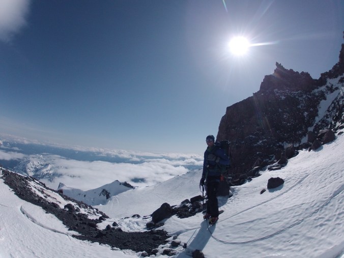
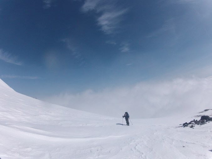
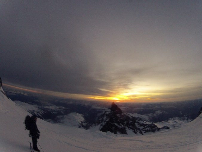
We’ve ascended this nightmare headwall, and arrived on top of this ridge. In this picture, you can see my partner in the very corner, but just down the ridge from him you can barely make out the two figures of Zach and Tom, our friends from camp.
I think I already mentioned that I, at least, had the feeling that any moment we would come to the obstacle that was the reason that only one team had gone all the way up. At this point, we were well off the GPS track of our route, on this ridge, looking up at heavily crevassed danger field. We speculated on potential routes, and thought we’d collaborate with our friends when they headed up.

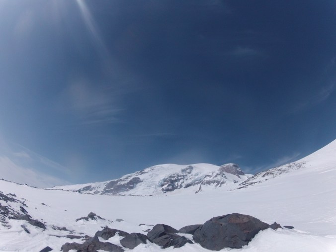
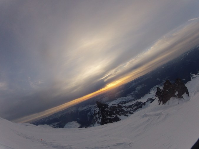
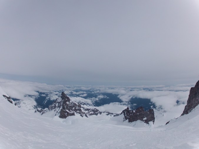
That’s Mt. St. Helens in the distance
The guys came up the ridge, and they felt pretty confident about the line they’d been scoping from a little lower, so they headed up slowly betwixt two large crevasses that may or may not be connected, hoping for a strong snow bridge, Tom driving his axe in with every step.
We headed up behind them, and I thought, once this was all over, I would share the morale apple cobbler with our new friends.
This part was nerve wracking, and I was very nauseous and a little shaky now after all that adrenaline had worn off. It’s more than a little unnerving to know that under each step, there may or may not be anything but a couple inches of snow and a lot of nothingness. As we crested the next point, the top of this section, we could see that actually, this steep snow climb just continues forever.
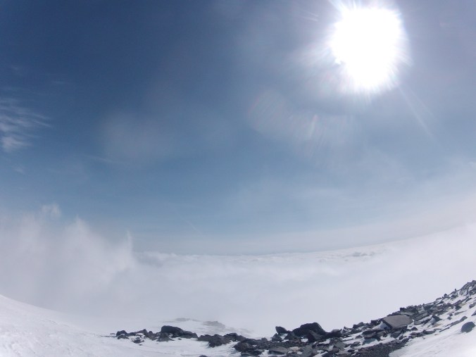
Which is a mindfuck, right? Just side step after side step of steep snow and bears everywhere, although they’re getting smaller as we get higher. Sometimes, they look filled in, and sneak up on you. Sometimes, they look filled in but they’re not, really.
This section really dragged. I was still wondering what was yet to come. My watch said we had quite a lot of gain left to go, and I was unsure if over the top of one of these crests we would find something really spicy, or what anything might look like. I started to think about, if I died, how screwed my family would be trying to sort out my life. This is silly and very specific, but I thought, my parents won’t know where my storage unit is, and the bed my dad made me is in there, and they wouldn’t want to lose that probably, but since they don’t know where it is, they won’t know to get it out (nor would they have the key, which was in that monstrous rental car in the Paradise parking lot) or pay the rent on the unit, and what if Jim sells my stuff because the rent’s not paid? And I though, well at least Pip is with her family.
Dan stopped, and I don’t remember why it came up, but I admitted to him that I was struggling with morale, despite that high morale is usually one of my major strengths. “Actually, I’m thinking about what would happen if I died.” He looked nonplussed, and handed me some chocolate. “Don’t do that.” I’m pretty sure is what he said.
I started counting my steps, 1-100, and we carried on. Side step, side step, side step, side step, switch axe to other hand, change foot direction. Side step, side step, side step, side step. 98, 99, 100, 1, 2, 3 … infinity side steps.
I saw on my watch when we had 1000 feet left, and I couldn’t believe it. Side step, side step, step over tiny crevasse, side step. Cross over. As we ate up more feet and rose in elevation, I started wondering if this was really going to be it. Could there be one more pit of despair that blocked us from the summit? When we were getting really close, something caused us to stop for a moment, and neither of us were that stoked. My belly was raging and I couldn’t do anything besides apologize and poop into a blue bag. When we got back up to continue, it was mere moments before we reached the crater rim.
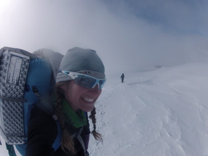
We saw our friends’ packs stashed there, and the guys in the flesh heading towards us across the crater, after being the 4th and 5th people to stand on the summit all winter. We removed our packs and adjusted our gear so we were only carrying essentials, and headed across the crater.
We arrived at what looked like the high point of the rim to find that another point further along the rim looked higher, so we continued.
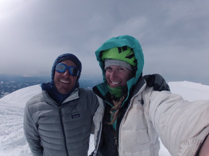
I wish so much that I could say we were celebrating, that it was all joy and excitement and maybe even tears, high fives, and hugs. I think the anticlimax had a lot to do with the descent that we still had ahead of us. But looking back, after all that had happened, we were there. Standing on top of motherfucking Mt. Rainier in the winter. We had done it, despite the 5% whatever chance that Ranger Seth had given us. Despite the crappy weather forecast, and the playing of the weather lottery that we were doing in the first place by booking plane tickets for a notoriously volatile mountain. Despite the bears that were fucking everywhere. Despite the piles of new snow accumulation that might have created a high chance of avalanche. Despite our legs that were screaming from carrying around an extra 50 pounds for a couple days. Despite the fucking fear that plagues anyone doing anything interesting. Fear that you could die here, fear of discomfort, of falling, of failing, of not being good enough, of being alone up there. Of feeling so, so very small. I’ve met a lot of climbers that have big egos, which is so absurd because if you spend any time up there, the mountains will put you in your place.
But here we were. This holy mother of mountains had allowed us to share her bigness just for this moment.
Of course, it didn’t seem real, yet.

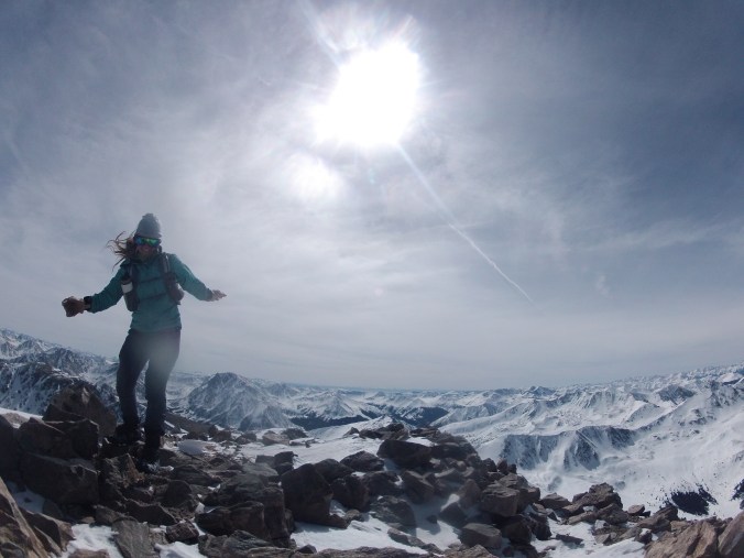
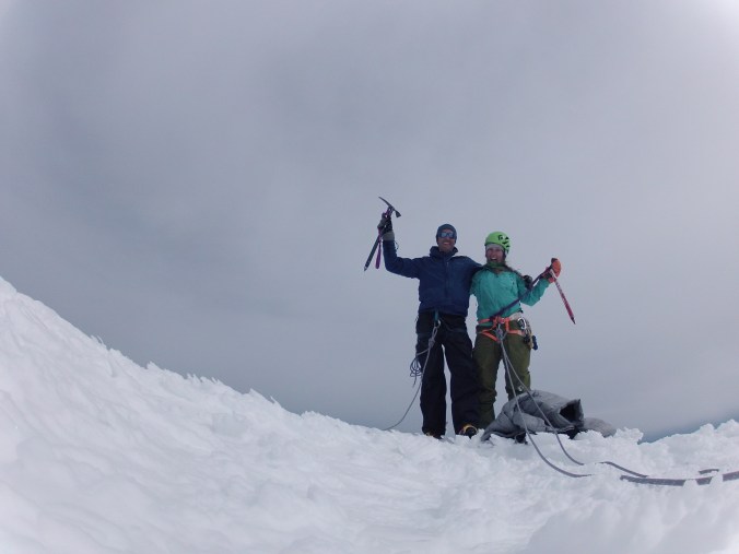
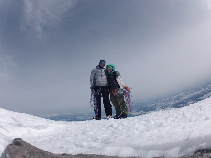
We were the 6th and 7th summits of the winter.
Looking back from where we came from, it looked like that point might actually be higher. So we trudged back and took more summit pictures just in case. When we got back to camp, I’d ask the Zach if they knew which point was the summit, and he said no. We then asked the other Dan, who had summited Rainier 8x, and he also said no. We consulted a map, and Dan told us that every time he’s been on either one, the other looked higher. I would eventually find out, after making it back home to CO, that the difference was between Point Success and Columbia Crest, and that the northern point, the second we visited, was actually slightly higher. So we have a lot of summit pictures.
We had a snack back on the crater rim, and I sent the “summit” message on the SPOT, as I had left it in my pack and neglected to take it to the actual summit.
Mt. Rainier is still an active volcano, which is very easy to remember when you’re standing upon its crater. It last erupted in 1894, and I can’t find exactly how high it used to be, but apparently it lost a lot of height in that eruption. It’s on the decade list, one of the 16 volcanoes in the world most likely to erupt in the next 10 years. They say that the ash and mud flows could bury the PNW, from Vancouver to San Francisco. Apparently, up to five earthquakes are recorded near the summit of Rainier every month. I hadn’t ever yet met a mountain that was this alive.
The story of the descent isn’t very interesting. I tried not to trip myself and we came down the steep snow quickly.
We had to down climb the steep headwall, which scared the shit out of me. It was steep enough, remember, that one could not see their own feet beneath them. I laid out our options: building a deadman anchor with our picket and rappelling off of it, untying because a fall would take us both down and self arresting was unlikely on this steep of grade, or remaining tied in and attempting to belay each other off an axe anchor which might decrease the magnitude of a fall.
Dan said he wasn’t worried, and planted his axe to makeshift belay me down the first 20 feet or so, the steepest part of the down climb. I’m going to go ahead and admit that I was shaking visibly, and had to kick each step in 3 or 4 times to make sure it was good before I bore weight on it. There was a brief section that my axe and front points bit into like ice, which was glorious for about 10 feet of stability, then back to the unpredictable snow for what seemed like forever. Much longer, anyway, than the up climb of it. Dan came down like he was casually descending a ladder from his roof or something. Down climbing isn’t a strong suit of mine, but I feel as though I at least got a bachelor’s degree in it after what seemed like hours but was probably 30 minutes of gritting my teeth and hoping for the best.

Dan had shit to do for a minute, so I stopped and took some pictures and sat still for a bit. I thought about how I would describe this day to my parents. It was terrifying, beautiful, really hard, and amazing. We weren’t down yet, but we were most of the way to Camp Muir, and certainly past the worst of things, and I cried and cried, finally. My nervous system is well trained to stay calm and not cry until I can afford that energy to be wasted, and apparently I felt safe enough here.

Still, this place is just full of sleeping bears.
We wove through the icebox and bowling alley area, carefully following the route we took up. We jumped over the crevasse that had tried to eat me earlier. We tapped down the ridge on fresh ice, thick like the bottom of a tourist boat. We stood atop Cathedral Gap and looked back at Camp Muir. We had come a long way, and it looked like home.

“What is there to eat?” Dan asked.
“Noodles.” I answered.
The snow on the Cowlitz glacier was so wet from the sun, it was balling badly on our crampons and actually being pretty hazardous, so we stopped to take them off. The snow immediately hardened on the next part of the route, of course. When we pulled into camp, we untied ourselves, and I managed the rope immediately (why?). We were welcomed with congratulations and whoops of victory from all of our camp friends. I had been hoping they’d be here, instead of trying to descend the whole damn thing that night.
We had heard that the new forecast might include very high winds on Sunday, with a new storm system rolling in. We had discussed going down to Paradise on Saturday night, whatever ended up happening on Summit Day, but throughout the day it had become apparently that we would stay at Camp Muir that night, and especially moreso when we found our friends all still there, ready to spend the night.
“I think it’s going to be a while before either of us gets up to melt snow and make the noodles.” I admitted.
“Well, are there eggs?” Reese’s eggs, and yes, there were. Victory Reese’s.
It still didn’t feel real, that we had summited. I guess because we weren’t all the way down to safety, and so the climb wasn’t yet over. But it felt glorious, sitting out in the sun and shooting the shit, telling stories, looking at maps. Talking about all of our respective climbs. Craig and Dan had seen all of us converge on that ridge above the headwall.
“There’s two of them.”
“No, there’s all four of them.”
“What? That doesn’t make any sense.”
“No, look. They’re all up there together.”
And turned around shortly thereafter, too late of a start.
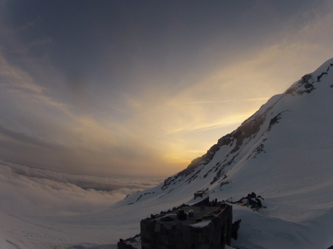
We made noodles and ate them. We sat outside a little longer. It’s tricky, because you can’t let yourself get cold, as you won’t be able to warm yourself up if you do. So one by one, we all ended up retiring to our sleeping bags. I got up a little later and made the Victory Apple Cobbler, a foil Backpacker’s Pantry bag that contained “apple mix” that I would cook in snowmelt for 10 minutes, or more at altitude, then “cobbler mix” that I would mix with snowmelt, spread on the “apple mix” and cook for another 5 or so. Kind of complicated for dehydrated backpacker food, I thought. I gathered the bowls of all of the occupants in the shelter and distributed a scoop to each, which wasn’t a large volume of food, but it was fucking delicious. Like, one of the most delicious memories I have in my life. And I’d wager, with the stunning realness with which I can taste it in my mouth right now, that I will always remember the taste of the victory cobbler, as we celebrated two teams’ successful Rainier summits with our friends at Camp Muir.
I woke up in the middle of the night to pee, unfortunately, and since it makes your body struggle to keep itself warm, you can’t hold it. So I got up and found a snowdrift by the door. I pushed it open, stepped out, and the wind knocked me flat on my ass. There was a raging storm.
I wasn’t the only one who noticed, because nobody even started getting up until around 9am, which means we were all laying in our sleeping bags silently for hours, hoping that the yowling wind, that sounded like an earthquake or another natural disaster, would go away. 70mph winds. The atmosphere in the shelter was as different as it possibly could be. Soberly, we melted water, made our oatmeal, packed our bags.
Zach and Tom were ready to go first, and, as they would be navigating with map and compass, which they were totally proficient in, I told them if they had any trouble, I was using trackback on the GPS and we would be following our track up precisely. A few minutes later, the other four of us were ready to go. Craig and Dan were on skis, and they were suddenly gone. Tom and Zach were still standing outside by the door. “I think we should stay together.” I agreed. The wind was so loud and hard that it drowned your voice immediately, and to talk, you had to lean to each others’ ears. Dan asked, “Are we going?” and I said, “Let’s go.” As we shouldered our packs, Dan disappeared, and Zach and Tom suddenly said “I think we should wait, I don’t think we should go.” And just like that, they were through the door into the shelter.
I turned to talk to Dan, but I couldn’t see him anywhere. I started yelling his name, and heard no response. Visibility was literally your feet, and that’s it. It turned out, Dan was less than 10 feet away, and the reality of the situation was as heavy as this mountain all of a sudden. We only needed to be a few feet away from each other to lose each other completely. And we would navigating fully blind, relying totally on the GPS to keep us from walking off a cliff or crossing onto the Nisqually glacier. I told Dan the other guys were going to wait, I didn’t know if we should too? He said, “Wait for what?” and he was right, the storm could have gone on for days, we had no reason to suspect it would clear in a few hours (it didn’t, it went on for several days).
So we started down the mountain. I was in front, pulling back my expedition mitts to check the GPS every minute or two. Dan immediately behind me, so that I could see his snowshoes, and he, mine. We took tiny steps. Because we couldn’t see anything at all, there was also no depth perception, and grade changes or even just changes in the amount of windsweptness threw us off and sometimes caused us to fall. The wind also knocked us down several times. Sometimes the wind blew so hard for so long, it seemed like we would never be able to move again, and might freeze into statues right where we were, in our stances trying to resist it. I followed every weave we had made on our GPS track. With no way of knowing what was meandering that we did, or what slight turns were made to avoid ridges or cliffs, I had to. I’ve never been so hot, but meanwhile, every inch of skin had to be covered because the wind would destroy it. Adjustments were obviously no option at all. We stopped twice, once for each of us to re-attach rogue snowshoes that had tried to bust off on the weirdly angled terrain, in addition to all the times we stopped to resist the wind and check the GPS.
It seemed like days. This was another good mindfuck, because you never felt like you were getting anywhere. There was only white, in the whole world. Just white, barren, hostile. Because I was responsible for navigating us off safely, the thought of dying out there was pushed into a corner of my mind, so instead, I could use all of my brainpower to stay calm and make good decisions. 1, 2, 3 … 98, 99, 100. We crossed light ski tracks a few times, and hoped our friends were safe.
I could tell we were getting to the base of the snowfield, and the steep, shitty couloir we’d have to descend to get off of it, but it was hard to tell which was it. The turn would be to the right, but all signs pointed to walking off of a cliff, basically. Dan thought he recognized one of the chutes, and there was suddenly a snow wand like two feet from my foot. It was marking our turn.
The descent in boots and snowshoes was already quite painful, and I already have a lot of toenail problems (including several dead and marked for falling off, but not quite there yet) and now, on this even steeper part, I ground my teeth against the excruciating pain of my right big toenail actually coming off, and the left about halfway. After leaving the snowfield and approaching treeline, the storm was much less terrifying, and we could vaguely see two figures about 30 feet away. We assumed them to be Craig and Dan, the skiers, and approached them, only to find two complete strangers. They were a couple that had plans of ascending the snowfield to Camp Muir to practice their skills, but had gotten lost in the storm the night before and now couldn’t find their way back to Paradise. We brought them along, and continued on.
After another seemingly hours (but was probably 45 minutes) there were tents, and people. Like, hundreds of people and tent cities everywhere. There was hustle and bustle, like the winter version of Burning Man. There were folks geared up everywhere, laying on the ground, being “rescued” by their partners. These were guided groups being trained in crevasse rescue and glacier travel, but presumably because of the storm, they were doing it right outside Paradise. This was the greatest feeling of culture shock I have ever experienced. My eyes were crusted thick with ice, as I had abandoned glasses because they were immediately fogged and covered in ice. We felt weathered, as we wove through these camps of humans pretending to do all the things we had just done.
The overnight parking lot at Paradise had two cars in it when we left, one of them being ours, and now it was full. There were maybe 75 cars. We dropped our packs and screamed at the top of our lungs, “WE DID IT! WE FUCKING CLIMBED MT RAINIER! OH MY GOD! WE REALLY DID IT! WE SUMMITED MT. RAINIER!” We hugged and congratulated each other and Dan said, “I finally don’t feel like we’re going to die anymore.” We got the Rainier beer out and cheersed.
Looking back, yeah, we risked our lives. We did some really dangerous shit, faced major objective hazards, and came out okay. It wasn’t because we were lucky, which we also were, but because we were ready. Hidden crevasses is one of the additional dangers of winter ascents, but that accident was handled perfectly, textbook, and I’m lucky to have such a good partner that did everything right. That’s why we take courses, practice, train. Climbing up and down that headwall was one of the scarier parts for me, but it wasn’t as dangerous as it was scary, that’s one of those mindset things. Navigating the Muir snowfield blind is how 200 something people have died on it, but we had our GPS and knew how to use it, acted carefully, and made good decisions, and it delivered us back to the car in excellent, if bedraggled and shaky, condition (along with some extra hikers that didn’t know how to use their GPS). Sure, we were uncomfortable and scared lots of times, but we weren’t in over our heads. I’m just so very proud of us for being calm and doing everything right, for being brave and strong enough. I had told the climbing ranger that we’re risk averse, and we are.
We stopped at Longmire to check out with our permit. “What should I write in comments?”
“Fuck yeah.”
“Okay.”
“Wait, did you actually write that?”
“Yes.”
The rangers were concerned about our friends Zach and Tom, as Zach’s mom had been calling, and I guess there was a discrepancy of when they were supposed to be back. They must not have a SPOT, since our moms were watching our every move on a map via satellite. We told the rangers every detail of the story, and that they were waiting it out safely at Camp Muir, and that yes, their moms could call us if that would help them feel better (they did). Climbing ranger Kelly called that evening to let us know that they made it out okay, they must have decided to go for it a few hours after we left.
We stopped to drop a few things off and use the bathrooms at Whitaker, and Dan said, “I want to tell everyone.” So we did. At the first gas station, we stopped for snacks, and it was overwhelming that you could have whatever you want, all laid out there in front of you. We weren’t even on the mountain that long. That afternoon, showered and dressed in regular people clothes after removing our sewer-smelling layers in the middle “transition section” of the rental car, we were eating pizza in Seattle, altitude: 3 feet above sea level. I can tell you, there is nothing more surreal.
The next morning, we packed up all of our [soaking wet] things and got in a metal cylinder with wings, that lifted up into the sky and brought us back to Colorado in about 2 hours. Just like that, it was over. The culmination of years of training, experience, courses, climbing, running, and living in the sky, just like that, was over. We had won the weather lottery, the trip was a complete success. We had summited Mt. Rainier.
“But the Hebrew word, the word timshel—‘Thou mayest’— that gives a choice. It might be the most important word in the world. That says the way is open. That throws it right back on a man. For if ‘Thou mayest’—it is also true that ‘Thou mayest not.’ Don’t you see?But this—this is a ladder to climb to the stars. You can never lose that. It cuts the feet from under weakness and cowardliness and laziness. I take my two pipes in the afternoon, no more, and no less. And I feel that I am a man. And I feel that a man is a very important thing—maybe more important than a star. This is not theology. I have no bent toward gods. But I have a new love for that glittering instrument, the human soul. It is a lovely and unique thing in the universe. It is always attacked and never destroyed— because ‘Thou mayest.’” East of Eden, Steinbeck

For anyone who’s interested, here’s our GPS tracks:
https://www.strava.com/activities/1484642139/embed/ead8fd472b750eaa278860b7953358baf9623fa6
https://www.strava.com/activities/1484642873/embed/1b771a629db605eabb42d104ca12acb5f200d1e7
https://www.strava.com/activities/1484643337/embed/d89e3285455babd6e0782f6e025746d9abe91dfe