Collegiates: two days of peakbagging, part deux

Day two was planned to be three summits: Huron Peak (14,003), Harvard (14,420), and Columbia (14,073). Plus much more mileage (26) and similar gain and loss (10,000ish ft).

Day 2 total elevation gain and loss: 8,900ft

Day 2 total mileage: 25miles

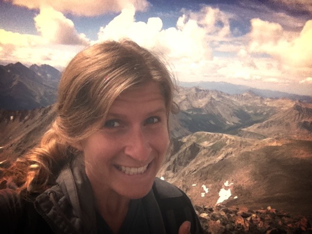
I didn’t wake up until just after 7a (that’s right, if you read day one you’ll know I slept almost 12 hours!) so I didn’t get an early start today either. Good things, though, it was raining all morning and I got up just in time to start Huron in the sunshine. Even the hike in to the Huron Peak TH was absolutely gorgeous, which would be a trend on this mountain.

That's not Huron Peak, it's to the left and hard to see from the hike in.

That’s not Huron Peak, it’s to the left and hard to see from the hike in.

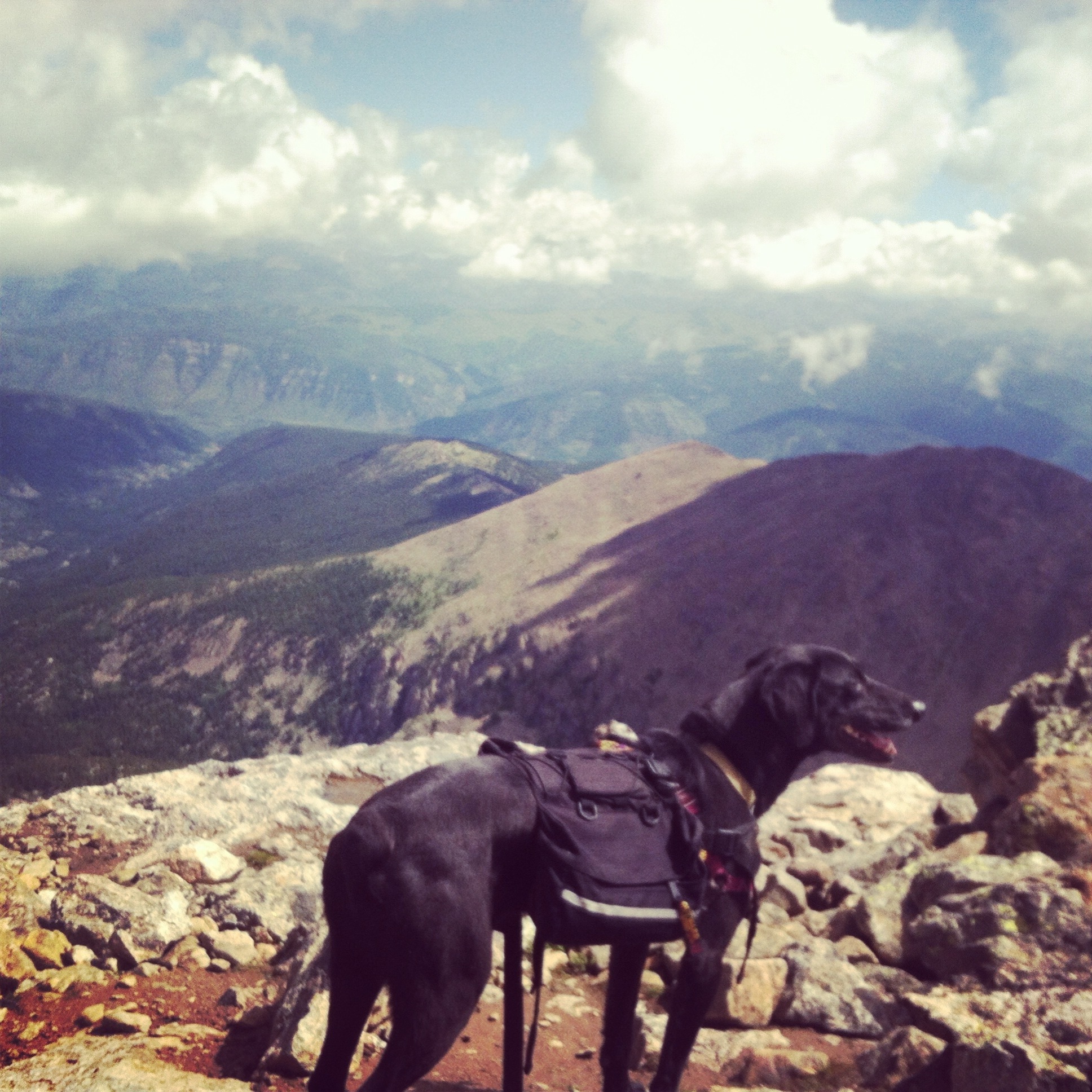
Luna was running in every direction, as if she wasn’t tired at all. At the TH there’s a brief bit through the forest, then the switchbacks start right away and they’re arduous but somehow don’t go on as long as you’re expecting, or don’t seem as miserable as they should. I didn’t see my first human until treeline; he was on his way down and gave me the dl on the rest of the hike. As promised, at treeline the trail opens up to cross this breathtaking meadow with spectacular views of the surrounding peaks. It is one of the world’s greatest tragedies that I did not take a picture on the way up (you’ll see why when you see the way down picture). We crossed the meadow then head into more switchbacks up the shoulder toward the ridge. This is where I started feeling the gain from yesterday in my legs, but more so in stiffness and not burning. I came across a group of 6 on the final ascent, they were all experienced hikers and we discussed the impending weather which seemed to be going from bad to worse. 2 of them made the summit and the rest turned around as I was heading up. I was only 400 feet off or so so we went for it. And my god, it was maybe my favorite summit so far.

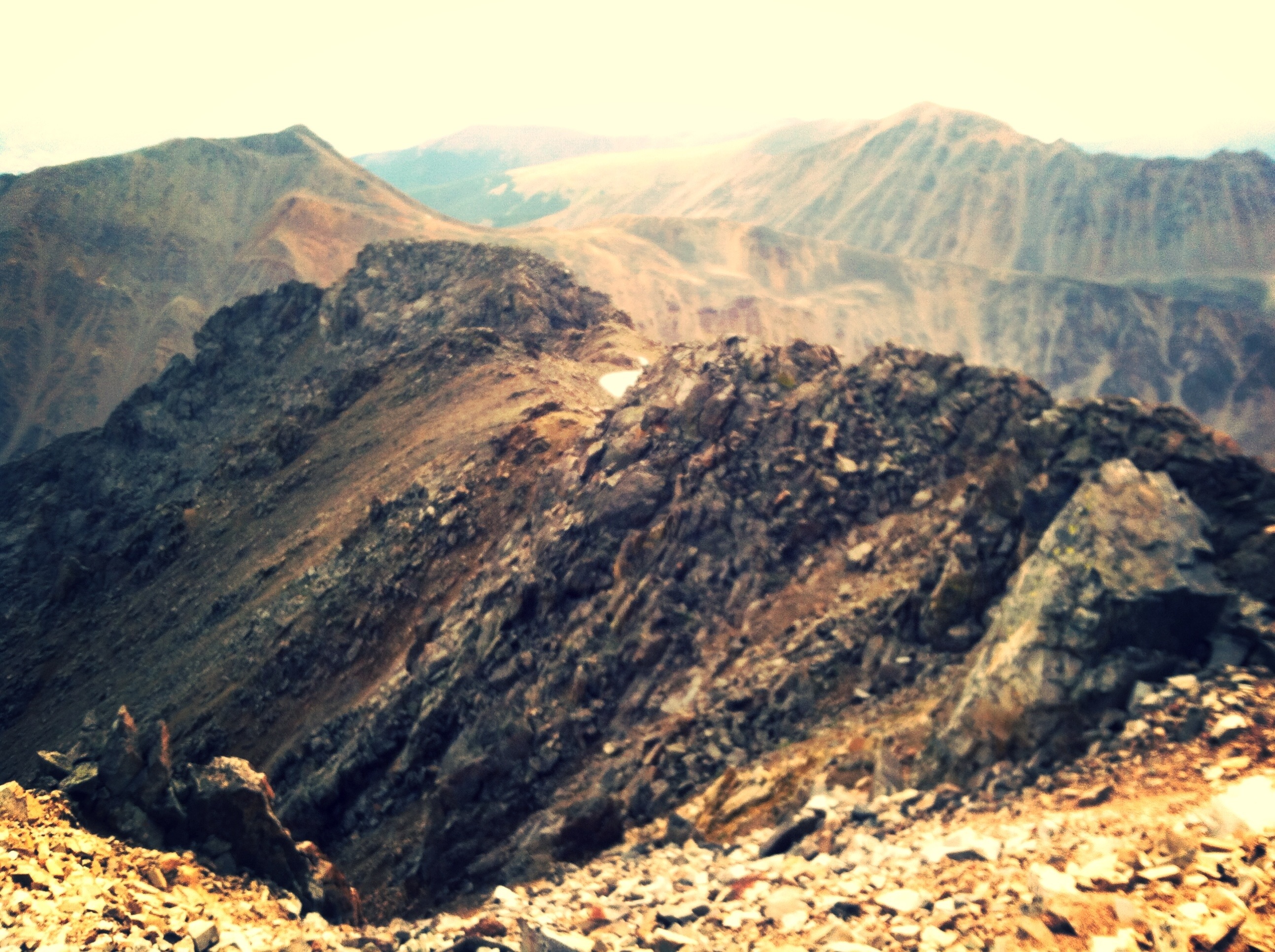
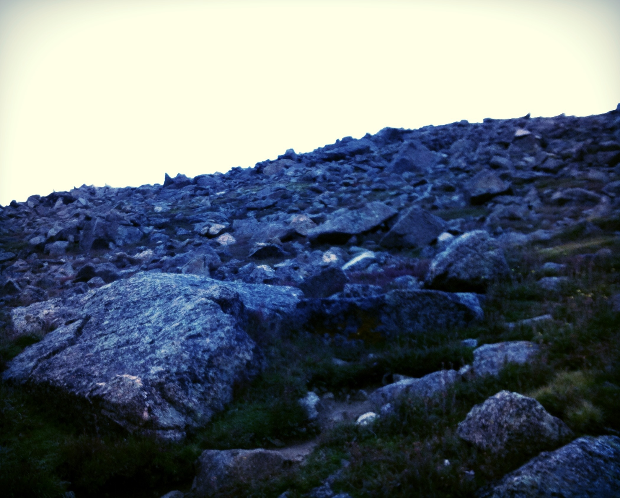
You can see in the video how quickly the weather can change. By the time I get all the way around the 360, you can see the storms getting so much closer. The snow got much worse as we headed down, and we ran down as fast as we could. By the time we arrived in the meadow again, it looked like this:

The ghosts of mountains in the distance cast a much different feel on the meadow

The ghosts of mountains in the distance cast a much different feel on the meadow

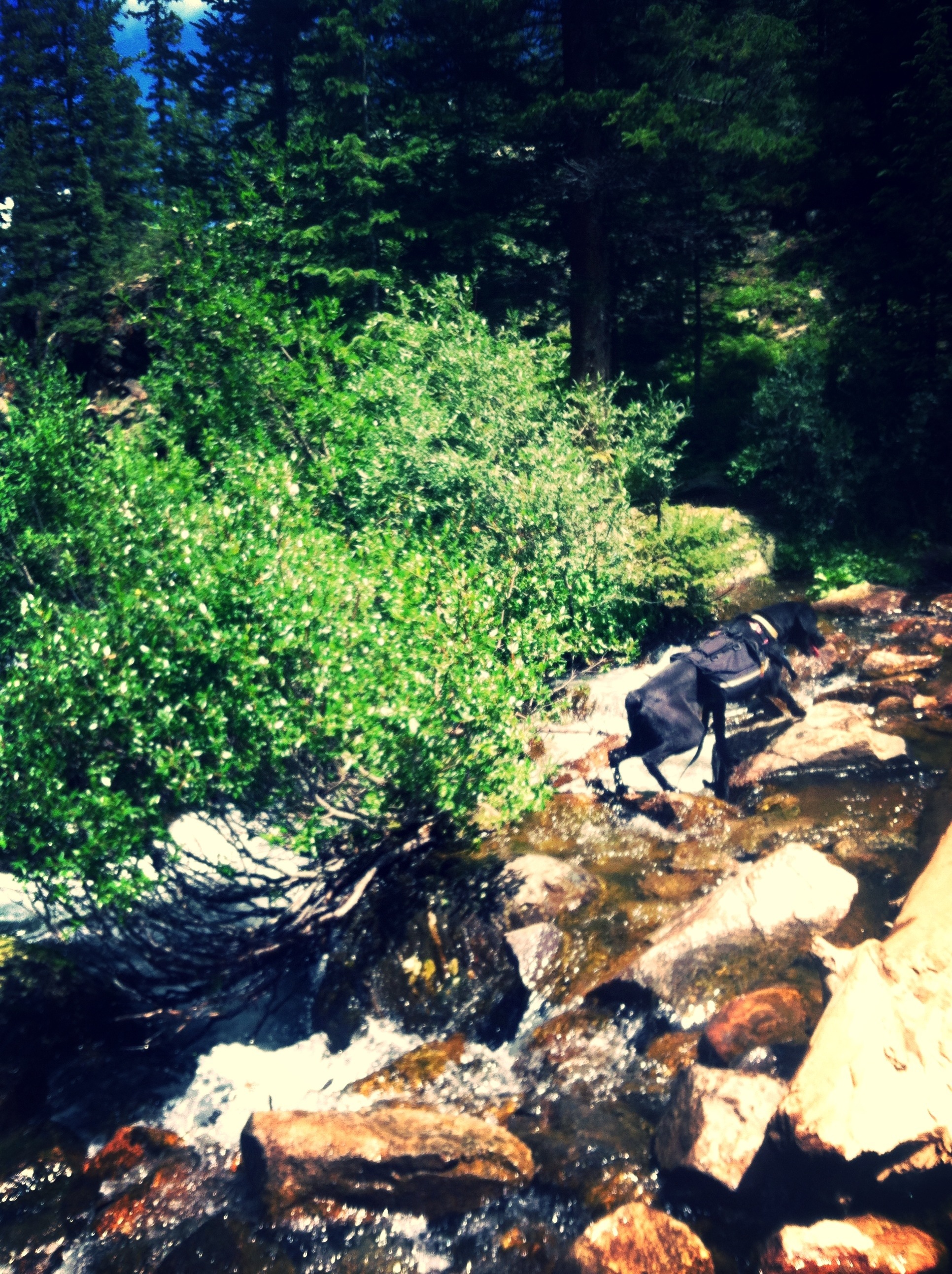
Once below treeline, it poured on us. Which really wasn’t bad and it wasn’t even that cold. The storm broke as we hit the TH, and the sun came out. Which was good news for the Harvard/Columbia attempt. I was feeling great. Huron was a straightforward 11 miles and 3,800ft gain, and it served to warm me up rather than tire me out (so I thought). Lu and I both had peanut butter sandwiches, and we headed for Harvard.

The first few miles in through the forest were sunny and nice, but the weather was turning slowly but surely. When we broke out of the trees and into the valley there were extraordinary views on all sides. It’s really miraculous how enormous 13ers and 14ers are, before you climb them. They humble us, certainly.

As I say in the video, I was feeling pretty rough at this point. The mileage and slow elevation gain was emptying me out just as slowly but surely as the weather was going bad. By the time we hit the talus field to start the last big ascent, I was pretty miserable. This is fun for me because the cool thing about 14ers is that you have that moment where you think “I’d rather die than keep going” but I haven’t felt that in a while, maybe since that miserable Pike’s ascent. So to find that again felt good in a weird way. Peakbagging and endurance hiking isn’t about conquering, as much as it may seem to be. You become a part of the mountain and you leave yourself on it. You always have a choice-to stay or go back. And if you stay, not just to stay but to dig deeper and go harder than you believe you can. That’s why I planned this trip, because the elevation gain was much more than I’ve ever done in the amount of time I was setting out to do it. Since I believed it to be past my limits, I wanted to prove that I could break out of them.

There was a mountain goat on Harvard, we actually came pretty close to it but it was around the corner and I didn’t want to spook it.

Can you find Waldo?  Me neither.  I know he's in the frame!  We're not even that far away.

Can you find Waldo? Me neither. I know he’s in the frame! We’re not even that far away.

The weather was turning quickly and the Harvard ascent took longer than I had imagined it would; which meant we were losing daylight too.

Right next to the summit, where I did not take even a single picture :(

Right next to the summit, where I did not take even a single picture 😦

We reached the summit and did another one of those quick taps and immediately started to descend, thinking we’ve got to bust ass if we’re going to make the Columbia summit before dark. It didn’t feel like a celebration or an accomplishment, making it to Harvard, which it should’ve! And I really wasn’t as familiar as I should’ve been about the route to and down from Columbia…I was a little nervous about doing it in the dark. We would descend from the Harvard summit to a saddle, then hike up an unnamed 13er, descend to another saddle, and head up to Columbia. That traverse would’ve been 2.54 miles, and was slotted to take over an hour due to difficulty and route-finding, and once on the ridge there’d be no escape if the weather turned.

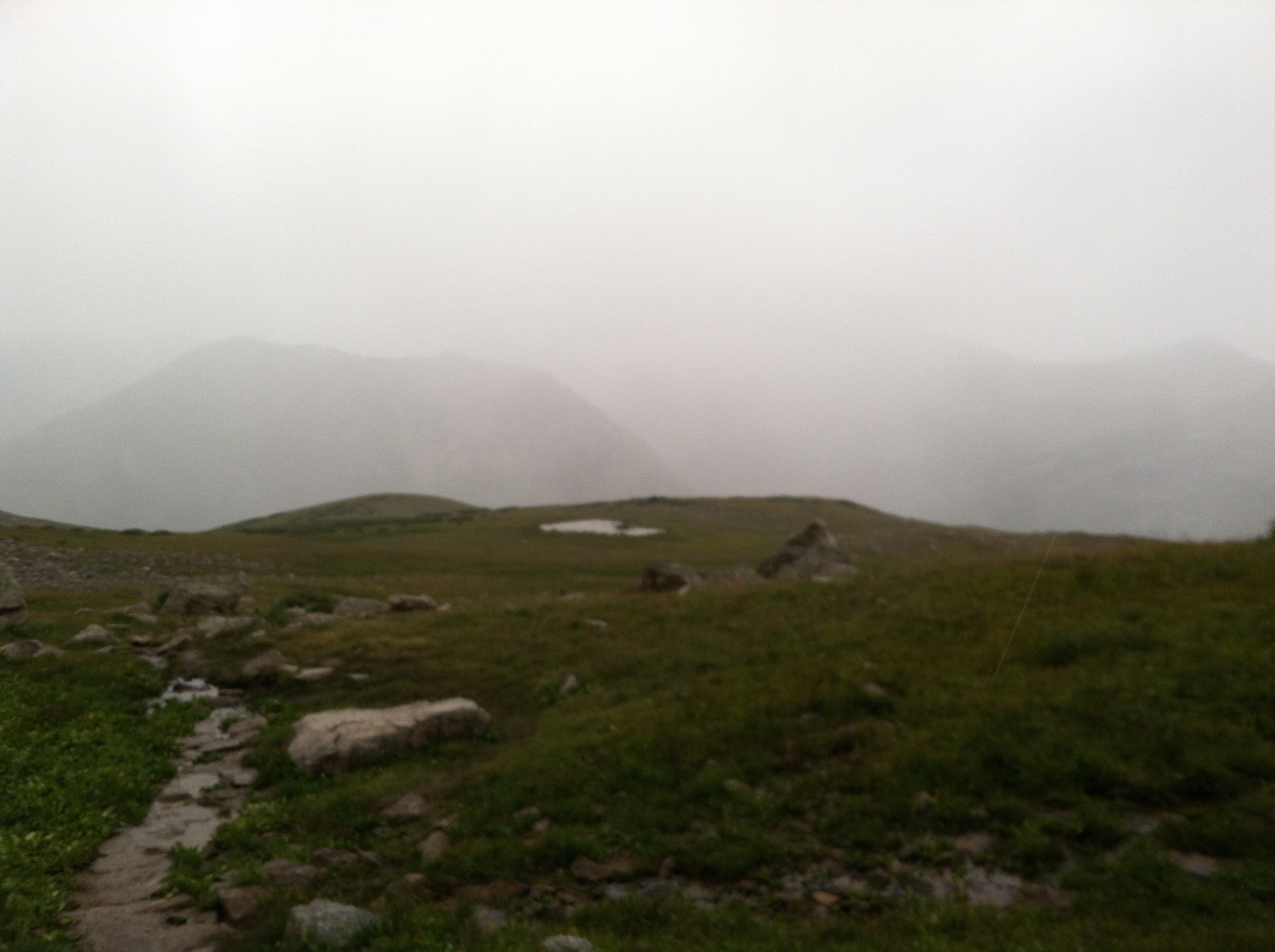
On the saddle before the unnamed 13er, I stopped, stared at it, and just shook my head. It was 7:20pm.

In 2 parts because my phone wouldn’t upload it in onehttps://www.youtube.com/watch?v=G570j-QO4EU

Here’s what’s really funny about the whole thing: the ridge I show you in the video, and the peak in the distance that I believe to be Columbia? It’s not! I told you, I wasn’t familiar with the route…whoops! Turns out, when I show you the creepy death eater fog coming over that ridge to the Northeast? That’s the ridge to Columbia. It doesn’t change the fact that I had to call it due to weather and losing light. We started descending immediately and were in the talus field (read: broken rock field) when the fog made it into the valley. Visibility wasn’t even 20 feet anymore, and then it started pouring (that was a close call!). Darkness fell completely while we were in the forest, we hiked back a little over 3 miles (felt like so much more) in total darkness. I had a light, but that doesn’t go very far. Darkness in the forest feels very heavy and thick. I sang devotional songs in Sanskrit to ward off the bears (and to help keep me from losing my mind-I’ve never been afraid of the dark, I didn’t know this would scare me so completely). I also discussed the impending fuel down at length with Luna.

Unfortunately for both of us, everything in Buena Vista closes at 8 or 9pm. Coming out of the Collegiate wilderness, it was a little after 9. We found one gas station still open until 10 (“summer hours” for one more week!) and got a coke. Coming back from BV you go through a variety of small towns (Fairplay, South Park, eventually Conifer) that also have no amenities “late” at night, so there was no fuel down to speak of. We didn’t roll back into Denver until 11:30p and by that point I just wanted to hit bed so hard.

5 summits over 14,000ft. 19,700ft gain and loss. 42 miles. I can be good with that.

Coming up: no sleep till we summit Columbia and finish the Collegiates. Sarah gives up sugar, and starts training for the Long’s Peak ride

Collegiates: two days of peakbagging, day 1

Day one served up three mountains: Belford (14,197), Oxford (14,153), and Missouri (14,067).

Total elevation gain and loss: 10,800ft
Total mileage: 17.5miles

On this trip, I took fewer pictures but made a couple videos. LMK what you think of this format!

We got an early-ish start. Ultimately, I was up later than planned packing and writing route directions out and I didn’t want to start this on no sleep, so I set the alarm a little later than originally intended. Then we got stuck in the blasting traffic near Idaho Springs. Belford went off without a hitch. There were storms forecasted for noonish, about 60% chance I think, so I was watching the sky pretty fervently and it was going back and forth between sunny and ominous all morning. A group that summited right after I did had been planning the Belford/Oxford double and called it due to the foreboding weather in the distance. Not enough for me to give it up on a day like this though! Lu and I headed down from Belford to the Southeast, on a low saddle that would provide a lot of cover should the weather turn quickly. Otherwise, both of these mountains were relatively barren. It was so windy, but the weather was holding.

Lu on the summit of Belford, looking out over the Collegiate Wildnerness (like a boss)

Lu on the summit of Belford, looking out over the Collegiate Wildnerness (like a boss)

We nearly got blown off of Oxford, and headed back down immediately to cross the saddle and head for Elkhard Pass. We would be taking a south ridge off of Belford to head towards the pass and to Missouri. The whole thing was very straightforward, and when we reached the pass there was a faint trail up a shoulder towards Missouri. Assuming this was the standard route that I was headed for, we took it.

Doesn't look so bad just yet

Doesn’t look so bad just yet

It turned class 3 very quickly, but I was undeterred, thinking it was just misclassified and Luna was fine. Then, just as we were approaching the final ascent to the summit ridge, it turned very much class 4. I was having a good time navigating this and still in good spirits, but Lu was getting stuck a lot, to the point that helping her was getting dangerous, and the last pitch was going to be impossible for her. I really wanted to give it a go, and even though she was right at the bottom I didn’t want to risk anything by not being able to get to her if something happened. So we descended the crazy ridge to look for the real route up Missouri. We lost a lot of elevation, but found the route and it was much simpler. It really didn’t take very long to get up all the switchbacks. As we approached the summit ridge (from the other direction) the storm clouds were coming in hot and we ran to the summit, tapped it, and headed back down as quick as possible.

This is actually from the ridge next to the summit, which currently has a terrifying storm cloud right over it.  The rest of the ridge was surprisingly sunny, so I stopped to take this real quick

This is actually from the ridge next to the summit, which currently has a terrifying storm cloud right over it. The rest of the ridge was surprisingly sunny, so I stopped to take this real quick

It didn’t start raining until our last 4ish miles, which was pretty miraculous. By the time we set up camp near the Huron Peak trailhead, it had mostly stopped raining. I even got a fire started on damp wood, which I was pretty proud of. Realized I didn’t have a can opener and haven’t replaced my lost multi tool yet so we were SOL with the baked beans I brought. More PB&J. I read Zen Mind, Beginner’s Mind and fell right asleep around 7:30pm.

Up next: three more fourteeners and much more mileage is on my plate for day 2!

la plata (also updates-hitting it hard, and sarah starts using brackets all the time)

With another Wednesday almost all the way off, I elected to get up at 3:30a to do La Plata Peak (14,336ft, 9.25mi) before the storms rolled in at 1 (something like 90% chance…and they started as we were pulling out). The TH was hard to find, you park off the main road then walk in like a mile, but it’s not marked well plus it’s unusual to walk in on a road without the TH in site. Naturally, I drove into the forest on a very bad service dirt service road and wasted about an hour, looking for the TH and only finding a bunch of obscure signs and random, unmarked roads. By the time I rolled back out to the main road where the TH parking is, I was super frustrated. So frustrated that I was about ready to head home (whoa nelly, Sarah, calm your shit down). I parked and got out, just in time to meet up with a couple that were walking around in confusion as well. We walked in on the road together and found the TH and I departed from them pretty quickly, ready to burn up the mountain fast and dirty (with all that extra vigor for getting so annoyed about nothing). [fun fact: the couple had only eaten chocolate frosted donuts for breakfast-I abstained from telling them how well *that* works out]

Mama nature, you stop it with your damn epic views.  I'm so tired of hiking with gorgeous backdrops all the time! #nofilter

Mama nature, you stop it with your damn epic views. I’m so tired of hiking with gorgeous backdrops all the time! #nofilter

Once you get out of the forest, the views get amazing and you hit the brutal switchbacks that are the worst part of the route. I passed two decent-sized groups that were split up over the switchbacks. Several of the poor dears were carrying gallon jugs in one hand and a couple of the girls were wearing purses [wondering what happens to them? I’ll see them later]. They loved/hated Luna, exasperatedly commenting about how epic she is and WHY DOESN’T THE ELEVATION EFFECT HER?! Business as usual.

The switchbacks were over before we knew it, and we continued through the meadow eating PB&J without stopping. The ascent up the ridge was grueling and somewhat terrible because the whole time it looks like you have so much more to go. The first couple I saw descending told me that it’s not as far as it looks. I disregarded this information, thinking “oh. really. it looks fucking far.” Then it turned out, maybe 5 minutes later we hit the saddle and you could see there was only one last little bit of talus hopping to the summit. [Here’s an aside for you: when I suddenly got interested in mountaineering, I was mildly annoyed at the constant use of talus and scree in trip reports and route directions. I gleaned a basic understanding, that both were referring to broken rock bits. I assumed there were solid definitions of each, but it turns out NOT. They both refer to broken rock bits, or a formation made of broken rock bits. Neither is specific to size. Scree comes from skrioa, Norse for landslide. Talus comes from the same word in French, meaning slope or embankment. Now, you can refer to talus and scree with pride and look very cool. You’re welcome.]

Luna sizes up some rocks.  See?  How hard was that?  Just call it like it is.

Luna sizes up some rocks. See? How hard was that? Just call it like it is.

While scree-hopping (see what I did there?), we came across a whole group of teenage girls that I was initially annoyed by (SO. LOUD.) but that quickly spent 15 minutes petting and fawning over Lu. So I cut them some slack. Evidently, Colorado summer camps take field trips to hike fourteeners. I was pretty impressed with these girls, as there were plenty of grownups still heading up the switchbacks and crying about it.

Me giving you a thumbs up on the summit.  Because I'm cool like that.

Me giving you a thumbs up on the summit. Because I’m cool like that.

We took some time to hang out on the summit, but with my later-than planned start and what I assumed were impending storms, we headed back down pretty quickly. [MORE BRACKETS. There was a family of 3 on the summit eating Subway sandwiches…it was like 10am, so they must have purchased them the night before? This bothered me and I spent more time than I should’ve thinking about it]

The gorgeous Ellingwood Ridge, named for the first person who climbed it in the 20'sish.

The gorgeous Ellingwood Ridge, named for the first person who climbed it in the 20’sish.

On the way down the main ascent, we stopped to tell our fellow travelers that it’s not as far as it looks and they gave me skeptical looks. I ran into both groups of newbies, one about to tackle the ridge with fear in their eyes, and the others lunching in the meadow with resignation. Both stopped me to talk, and I tried to give them an accurate assessment of what was coming next, but it turned out they were uninterested in my guesstimates of time to the summit, or in my warnings of the coming storms. They wanted to talk about Lu, quel surprise.

because Lu is the shit, obv

because Lu is the shit, obv

The hike down was uneventful, which was good, because the storms didn’t hit until I was all the way to the car and on 24, headed back to Denver. And hit they did, hopefully everyone that was up there made it up/down safely. When everything was said and done, I was home by 3p! Definitely a successful trip.

Getting ready for collegiates, I put in a whole lot of time running:
Friday 4mi Matty Winters
Sunday 7mi city
Monday 8mi Mesa Trail (this is the infamous bear run)
Tuesday 7mi Dinosaur Ridge
Wednesday 4mi Matty Winters

Things got filthy dirt on dinosaur ridge

Things got filthy dirt on dinosaur ridge

I’ve shaped somewhat of a plan for the Collegiates: one day is Oxford/Belford/Missouri and the other will be Huron/Harvard/Columbia. I’m getting pumped, TWO WHOLE DAYS in the woods?! Shit’s about to get all kinds of rad.

Stay tuned for delicious raw energy ball recipe and updates on the Collegiates trip coming up fast!

xo

Monday run (and then we met a black bear & luna saved my life)

“Can you tell me what it looked like?” -ranger, via radio
“It was brown.” -me
“Did it have ear tags?” -ranger
“I have no idea, I was looking at the inside of its mouth.” -me

In preparation for our upcoming Collegiate Peaks run, Luna and I were “training” by putting in trail miles just in the front range. On Monday, we were on the Mesa trail about 4 miles south of the Flatirons, just past Mallory Caves. I was having one of the best runs of my life, really in the flow, feeling great. Lu was off leash, on the edge of the trail, running in stride with me. It was noonish, sunny, and there were a whole bunch of people on the trail.

There was a rustling in the bushes right next to us and a bear appeared. It was brown, but I gather there are brown versions of black bears (which are the most prevalent bear in Colorado-some say the only type of bear). It stopped in front of me and reared up. Standing, it was nearly as tall as me. It growled/roared (could’ve been either, not sure what the technical term for bears yelling is). I stood there, totally still. Not able to bring to mind what it is you do if a bear charges you. Fully thinking “so this is how I die.”

It came down on its feet again and turned toward Lu. It happened in a split second, she took off and it followed her in hot pursuit. So what did I do? Ran after them as fast as I could. Bears can run up to 30mph, apparently. They turned a corner and I couldn’t see them anymore. About 2 minutes later, I heard the bear turn up the hill back into the brush. It was sort of jogging relatively slowly. I was certain it had gotten her and was dragging her body back to its den and I started screaming her name.

From around the corner someone yelled “your dog’s okay!” and I started running again. Turns out there were two girls on the other side of the hill that saw the whole thing-Lu and the bear ran right past them, and they saw the bear give up essentially. I started yelling for Lu and she was far enough in the distance that I couldn’t see her but she headed my way and soon I was holding her. Not a scratch on her, she looked like she just finished playing an epically fun game of chase. By deflecting the bear and outrunning it (which a human could not do, btw), that little dog saved my life (and hers).

I chatted with the girls about what happened for a bit, then started back towards the car, stopping to warn everyone headed in that direction. I unplugged my headphones so Run DMC could be my new bear deflection system. Every time there was a slight sound in the woods I jumped like three feet. Back at the ranger station, I reported what had happened. The ranger taking my report was pretty disinterested, but did take down all of my contact information and told me they or Fisheries and Wildlife might need to contact me (weird, what for, right? nobody did, that I know of). When I spoke to the ranger in the field via radio, he was shocked when I told him the whole story. He said an aggressive bear usually means cubs nearby, but the location that the bear started and ended didn’t make sense for cubs. The best either of us could figure out is that we surprised a bear that was feeding nearby to the trail by sneaking up relatively quietly, and because it was startled it became aggressive.

black bear; obviously I didn't take this

black bear; obviously I didn’t take this

Things about bears that you may or may not already know:
-don’t even run from a bear, or climb a tree. they’ll chase you; they can run 30mph and climb trees amazingly fast.
-black bears aren’t aggressive unless they think they have to be
-if you see a bear, get loud and big, and back away slowly. you want it to think you are not a threat but also too much work to take down
-if a black bear attacks you, FIGHT BACK. you actually have a good chance of it deciding it’s not worthwhile to continue
-if a grizzly bear attacks you, play dead.
-grizzlies range in color from blonde to dark brown, and tend to be larger. Because of their reclusive nature, it is rare for humans to see them at all.
-black bears range in color from blonde to jet black, and tend to be smaller. Their hair is shorter and of a different texture.

BEAR PREVENTION: when in the woods, make noise. all types of bears will try to avoid you as much as possible and that’s why we don’t see bears very often. if you’re often by yourself, get a bear bell. don’t carry an open container of fried chicken. don’t bring any food into your tent if you’re camping.

grizzly bear.  notice the rougher hair, larger frame, and muscular hump on its back

grizzly bear. notice the rougher hair, larger frame, and muscular hump on its back

Mt. of the Holy Cross (hiking alone)

Important things that you think about on long solo hikes: we say depth instead of deepness…but steepness instead of stepth. WHY!?!? I could probably find out why now that I’m home and have access to the internet, but I spent hours considering this serious problem on the trail.

This was actually at the end of the hike, looking cool

This was actually at the end of the hike, looking cool

I do love hiking with friends; people I knew before and some that I meet along the way. Casual conversation helps ease the steepness, helps you keep pace, pass the time, and especially not lose hope when the going gets rough (like miles of snowmelt flooded willows as you’re losing light). But there is something special about facing all of it alone from time to time.

The Mt. of the Holy Cross (elevation 14,003ft) starts off with a good amount of gain pretty quickly, in fact you hit treeline before you make it to Half Moon Pass in the first couple miles. At the top of the pass, two things happen: sweeping, epic views of MTOTHC, and now the trail heads steeply down (and loses not only all of the elevation you gained, but maybe even a little more).

The view of MtOTHC from Half Moon Pass

The view of MtOTHC from Half Moon Pass

At this point, the weather was pretty ominous. I was getting a later start than I planned (hit the TH at 8a) and I heard it was a good thing-it rained and hailed until about 7a, maybe a little later than that on the summit. It was still looking pretty dark up there as I descended Half Moon Pass and headed for the river crossing that would lead me to the ascent.

A big descent early in the hike is a bummer for so many reasons-you lose what you’ve already gained, you realize you’re going to have to gain it all back again (and then a lot more), and most importantly, the out-hike is going to have a long ascent on it when you’re already exhausted. And we all know, the main rule of hiking is, the way out always feels much, much longer than it actually is.

The main ascent was what I’d like to call arduous. I was in a hit-it-and-quit-it mood because of the weather, and because I had to be back in Denver by 5p to teach class at 6. So I burned up that mountain like a…I’ll have to come back and insert a clever simile here. Anyway, there weren’t a whole lot of hikers out, I came across two heading town that gave me weather reports from the summit (hail) but optimism as well-“the clouds are moving quick”. In total I think I saw 7 people (even though there were at least 20 cars at the TH-where were they??).

At the top of the ridge that leads to the final, the trail evens out for a bit, providing a break (although the trail is all small, loose rock, so is it really a break?) I had a good view of the final and the summit for a while (good news: the weather cleared, bad news: I thought it looked far and rough-with no conversation to distract you, that’s a fun mental game). Starting to attack the trail quickly gets lost and things get technical and scrambly very quickly. Luna was rock hopping, as usual (and, as usual, I think all 7 people on that mountain commented on her epic capabilities, grace, stamina, agility…), and I really wasn’t fairing poorly. I was rocking my trail shoes instead of boots, which has become my norm for summer hikes, and I passed a group of 3 older gentlemen who were shocked to see someone in tennis shoes (they don’t even UNDERSTAND about trail shoes, yo) and assumed my feet were pretty torn up. I told them not to worry about it, this is my 9th summit this year in these shoes and my feet feel great 😉

Rock Hopper

Rock Hopper

Because of all the losing-the-trail confusion (made even more fun by the cairn game-found a cairn, but where’s the trail?) and rock hopping fun, I hit the summit in no time at all and was shocked to realize that was it. The clouds had even broken and we had a few sunny minutes on the summit before I decided to roll.

Luna #caninebadass enjoying the summit sweetness

Luna #caninebadass enjoying the summit sweetness

The descent was fast and dirty. We even ran part of it, trying to get out as quick as possible. Well, I ran part of it. Lu ran the whole thing and then some. I made a mental note about getting Lu sponsored as a #caninebadass endurance athlete.

Do you see that mid-jump!?

Do you see that mid-jump!?

The clouds rolled back in as we were approaching that hellish up-hill back to Half Moon Pass, and it started to rain. NBD, we were already safely into the woods. McDonald’s fries and Coke for fuel down! Back in Denver just in time to teach my 6pm class and head to the climbing gym for 3 hours! (fun new fact about climbing: climbers are not only super friendly, but pretty lazy. Initially I was only lasting about 45 minutes at the gym because I just climbed non-stop…until I found out that protocol is this: you climb a route, you sit down with the other climbers, and everyone talks about it for 5 minutes. Then someone else climbs a route, sits back down, and everyone talks about it for 5 minutes. It’s awesome! Definitely the most welcoming community to any sport I’ve become a part of.)