If you’ve been following along, on my quest to summit 28 mountains over 14,000 feet this year before my 28th birthday, I just bagged 5 summits last week in two days-my biggest trip yet. However, it was planned for 6, but in the last moments I had to make a decision that was disappointing but necessary-to call it before traversing the ridge to Columbia.
This meant I’d have to go back for Columbia. And I’ll tell you now, it was not a good day.
On Sunday I realized I hadn’t made any Labor Day plans, and my schedule the way that it is allows me to head to the mountains after my Monday morning class if I can be back for my Tuesday late night class-that’s *almost* two full days! So very last minute, I started copying down TH and route directions loosely for my next 6 peaks that would finish off the Sawatch Range- Columbia, Princeton, Yale, Antero, Shavano, and Tabagauche. Obviously, I wasn’t going to make those 6 in this trip (especially since there are no link ups, and the roads to several of these TH are sketchy at best, which means my mileage walking in to get these peaks is going to increase exponentially). I was hoping for 3: Columbia and Princeton on Monday, Yale on Tuesday.
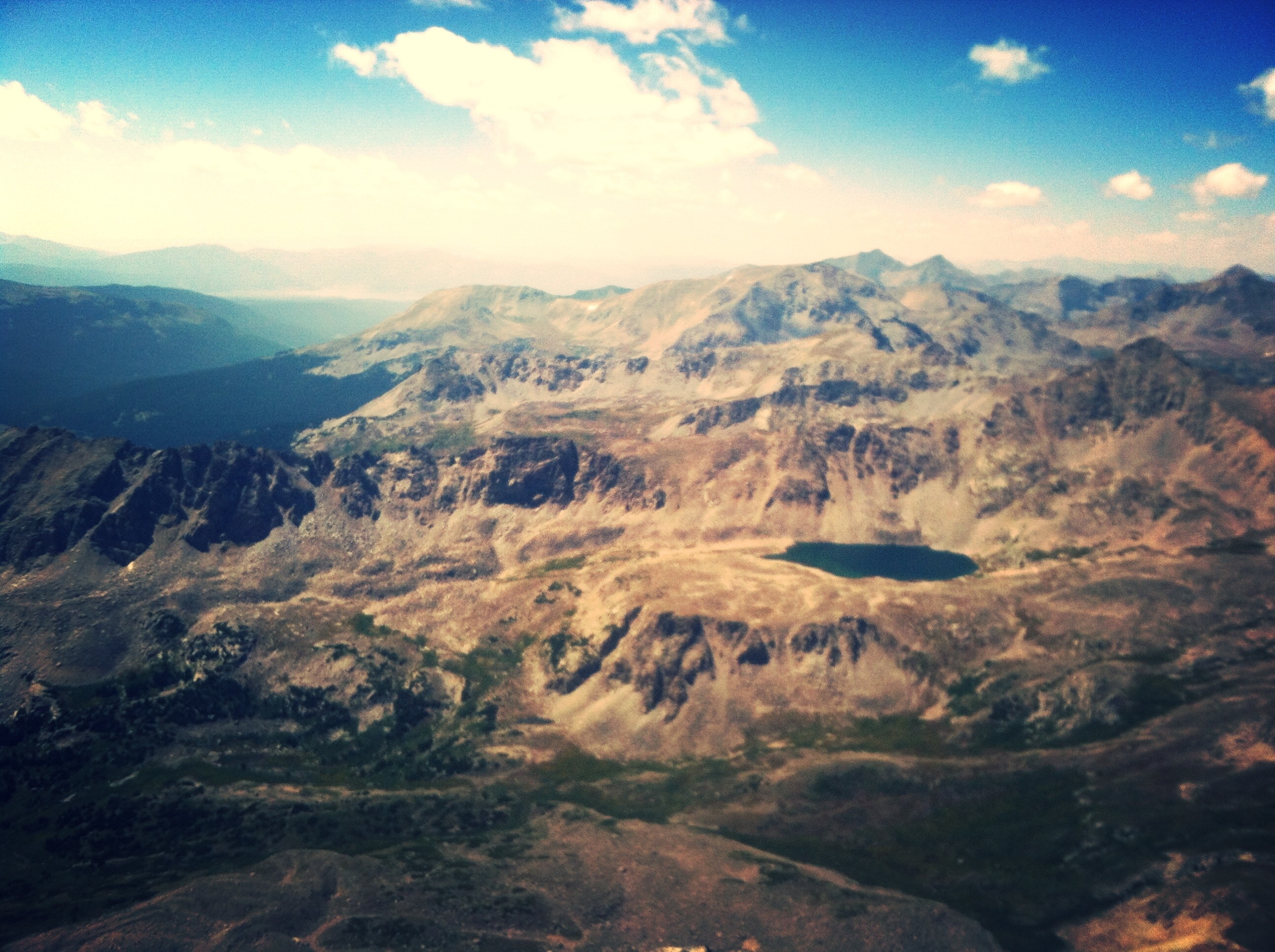
yeah I only took pictures from the summit on this trip. So. I’ll just spread them out through the post.
I started out at the Cottonwood Creek TH to hike in 3-4 miles towards Harvard before I veered East for Columbia. This was actually quite pleasant. The weather was excellent-warm and sunny, with no forecasted storms whatsoever. The trail wasn’t even crowded. We hit treeline and approached a gully. This is where my “loose” copying down of route directions failed me. When I’m taking a standard route, I copy down turns that must be made in case there are no signs, and anything that’s out of the ordinary (“the route is hard to find through the talus, go SE”, or “turn at the rabbit eared rock formation”). There wasn’t really much of note in the Columbia directions, but I had a recollection of reading about the route being hard to find “but follow the cairns” and something about a gully. So as the trail headed up a gully, I followed right along with it. It got lost but was vaguely findable the whole time. The problem was, it was EPICALLY steep and all loose dirt and tiny scree. About 20 minutes in, I was bear walking on hands and feet. We were in a west-facing gully, and the wind was just whipping us around. It literally knocked me over several times. The ascent up this gully was slow going, and I’ve never felt like I made so little progress in so much time. I was frustrated, even angry. If this route were alive, I wanted to kill it. It was a different type of the “I’d rather die than keep going” mentality. I wasn’t really tired, just miserable. I kept thinking “this isn’t that big of a deal, calm down!” but I couldn’t calm down.
We reached the summit ridge, FINALLY, and not only was the wind relentless, but we had a ways to go before the summit. At one point I actually leaned into the wind and it held me up. It was approaching 50mph. The only people we’d seen so far were beginning their descent, so we had the summit to ourselves. Now this was a satisfying summit to make, and we spent about 5 minutes feeling awesome about it and taking excellent pictures (I know, I should be a professional photographer). We also shared a banana-my last bit of food (I’ve been packing light. Damn. Fail.)
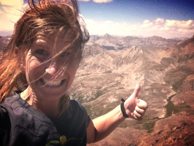
yep. Really good photographer. Plus, the wind blown hair makes me look like a professional model. So.
We headed to the descent fast and dirty, I was so ready to be off this mountain. I didn’t bring wind protection either, expecting excellent weather, so my head was starting to hurt pretty good from the cold wind in my ears. I also left my sunglasses on the summit. Angry face. We passed our fellow descenders as we ran down as quick as we could-and we did find that we missed the turn out of the gully to take the shoulder up to the ridge, which was much better (but still slippery and steep in places). Coming down the lowest segment of the gully, where the routes meet, I attempted the snowless version of glissading (aka, sliding down the steep parts on my butt) but that’s problematic because of the rocks. What did seem to work was kind of skating on my feet, which my hips just above the ground, and my hands steering on the rocks. This was pretty great (although most of the time you’re halfway between being in control and falling) until I landed my right hand on one of those giant, evil thistle flower plants. And now I’ve got 20 splinters, that are going to have to wait until later because I’m not carrying a first aid kit. Angry face. [update: there were four that I couldn’t get out. FOUR. ugh.]
At least I was about below treeline. So when I’m in the mountains I always think about wanting to be a better person. How to make more out of my life. What unnecessary junk I can and need to get rid of. This ascent, being particularly miserable, gave me more to think about than usual. I’ve been tragically hooked on Netflix lately, letting House run while I’m cleaning, while I’m trying to go to sleep, and while I’m eating. Awful, and I just keep letting it go on! What a time suck. I’ve also let my yoga practice sort of go by the wayside, not practicing at home and skipping class some days. Finally, I realized that sugar is causing my digestive problems. It’s time to make drastic changes.
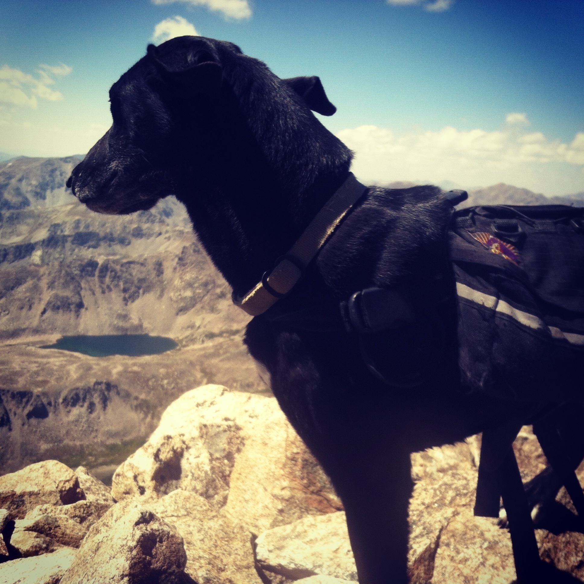
more summit pictures! Lu’s glamour shots. Here she is, looking regal
I made the decision on the way down to call it for the day, find a campsite, and do one summit in the morning. I was really looking forward to making dinner, reading, and doing some yoga. I had to drive to the next trailhead, so I headed toward Princeton. No camping at the Princeton parking lot, so I headed up the Mt. Princeton road (supposed to be 4wd only but it’s not THAT bad). After driving several white-knuckle miles up, I gave up and turned around. I hoped there would be better luck near Antero, so I drove further in towards Baldwin Gulch. On the way in, I saw lots of “no camping” signs. Hmmm, promising. Arrived at the Antero TH surrounded by ATV trails and parking, and no camping. More “no camping” signs. I drove in further with very little hope, then gave up and turned around. I could’ve gone back to Harvard but couldn’t stomach adding another 45 minutes of driving into the national forest. Frustrated and disappointed, I turned tail and headed home.
This trip gave me a lot to think about. “Learning” doesn’t come from outside of you; as you pick your way through experiences, you expose who you are and what you’re about.
Coming up: Sarah gets serious about putting miles in the saddle for the Long’s trip (164 bicycle miles, 14 running up Long’s, 15,000ft gain in 24 hours), and the Collegiates fire is burning a hole in something.

I love the shot with your hair blowing across your face, and would love to see more photos like this on any more windy adventures you have.